Visit EIA's U.S. Energy Atlas, our new interface for web map applications and geospatial data catalogue.
Overview & general
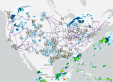
- Energy Disruptions
-
- Interactive maps with energy infrastructure and real-time storm tracking
- Historical Disruption reports
- Gulf of America Fact Sheet
- Flood Vulnerability Assessment Map
- Interactive map that includes flood hazard information from FEMA as well as energy infrastructure layers.
- State Energy Profile Maps
-
- Map Details and Data
-
- Federal lands
- Market hubs: NGL and natural gas
- Oil/gas refining and processing
- Oil and gas wells
- Pipelines and electric transmission
- Power plants
- Resources: coal, oil and gas, shale, tight gas, biomass, geothermal, photovoltaic solar, wind
- Storage
- Waterborne transport: petroleum ports, waterways, and LNG import/export terminals
Coal
Electricity & nuclear
Oil and natural gas
- Low Permeability Oil and Gas Plays
- Major tight oil and shale gas plays in lower 48 States
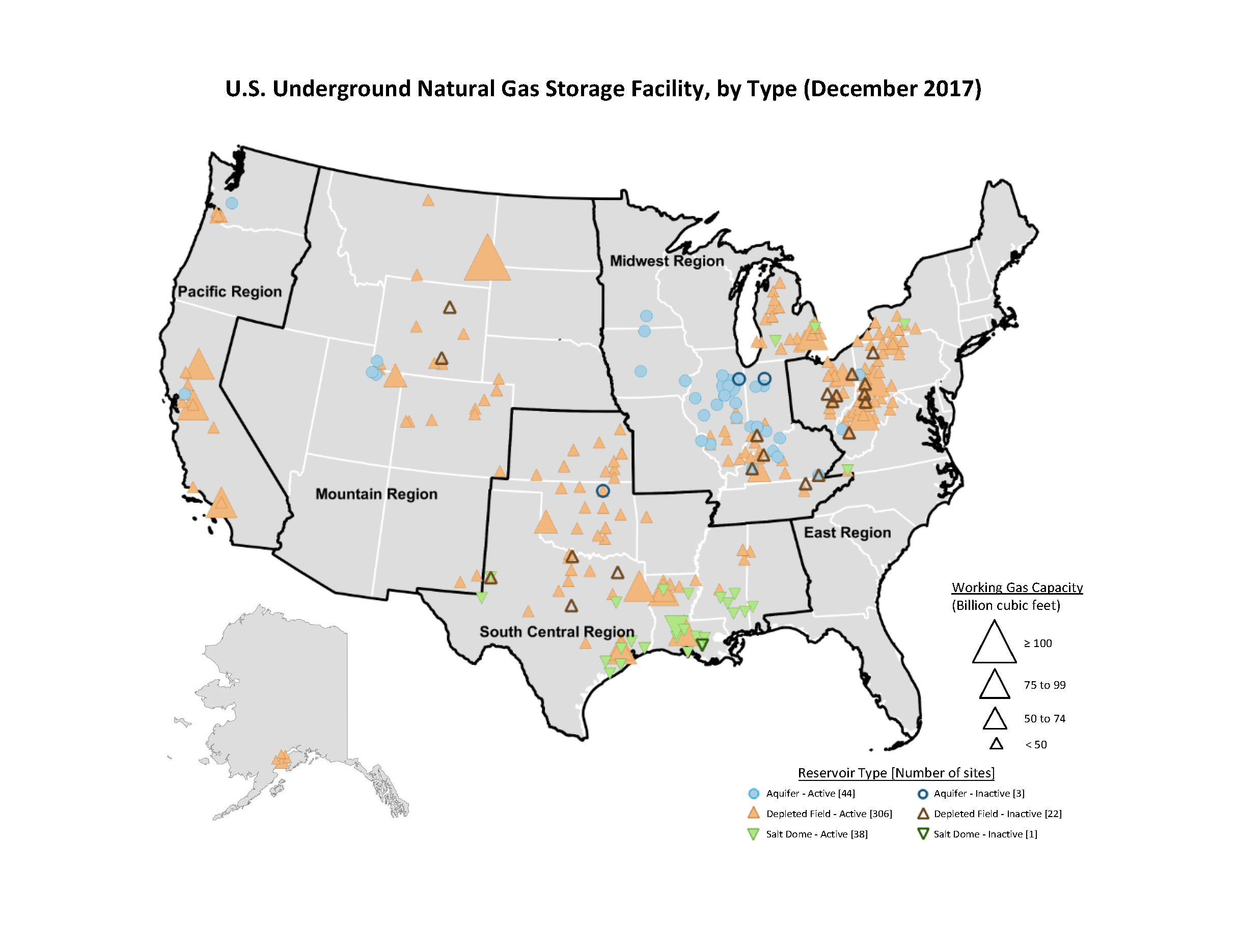
- Underground natural gas storage facilities
- Marketed production of natural gas in the United States and the Gulf of America, 2009
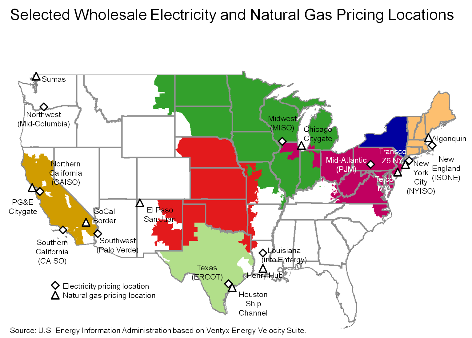
- Natural gas market centers
- Selected wholesale electricity and natural gas pricing locations
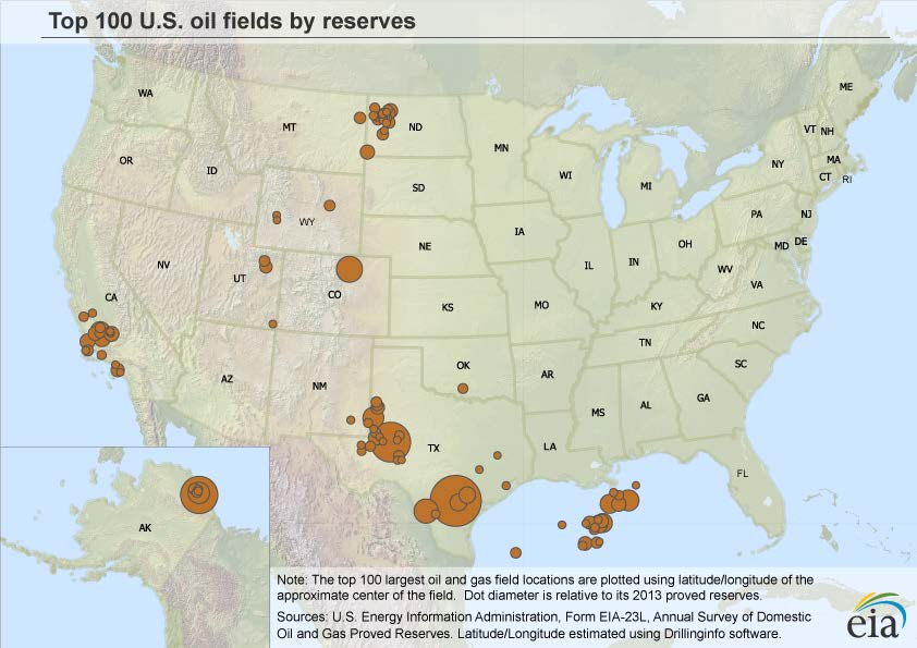
- Top 100 oil fields
- Top 100 natural gas fields
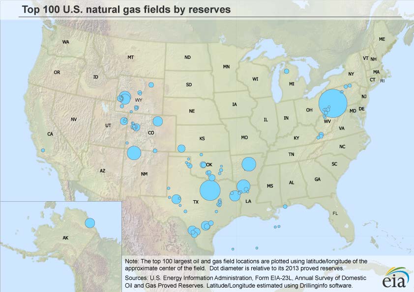
- U.S. Crude Oil, Natural Gas, and Natural Gas Liquids Reserves Summary, 2008 Maps of Selected State Subdivisions
- World shale gas map (Map of 95 major basins in 42 countries)
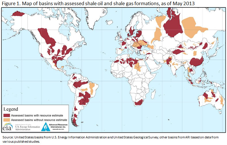
Renewable
- Solar maps
- Geothermal maps
U.S. Energy Atlas
Energy Disruptions