Oil and Natural Gas Exploration, Resources, and Production
Historical U.S. coalbed methane maps
Maps
-
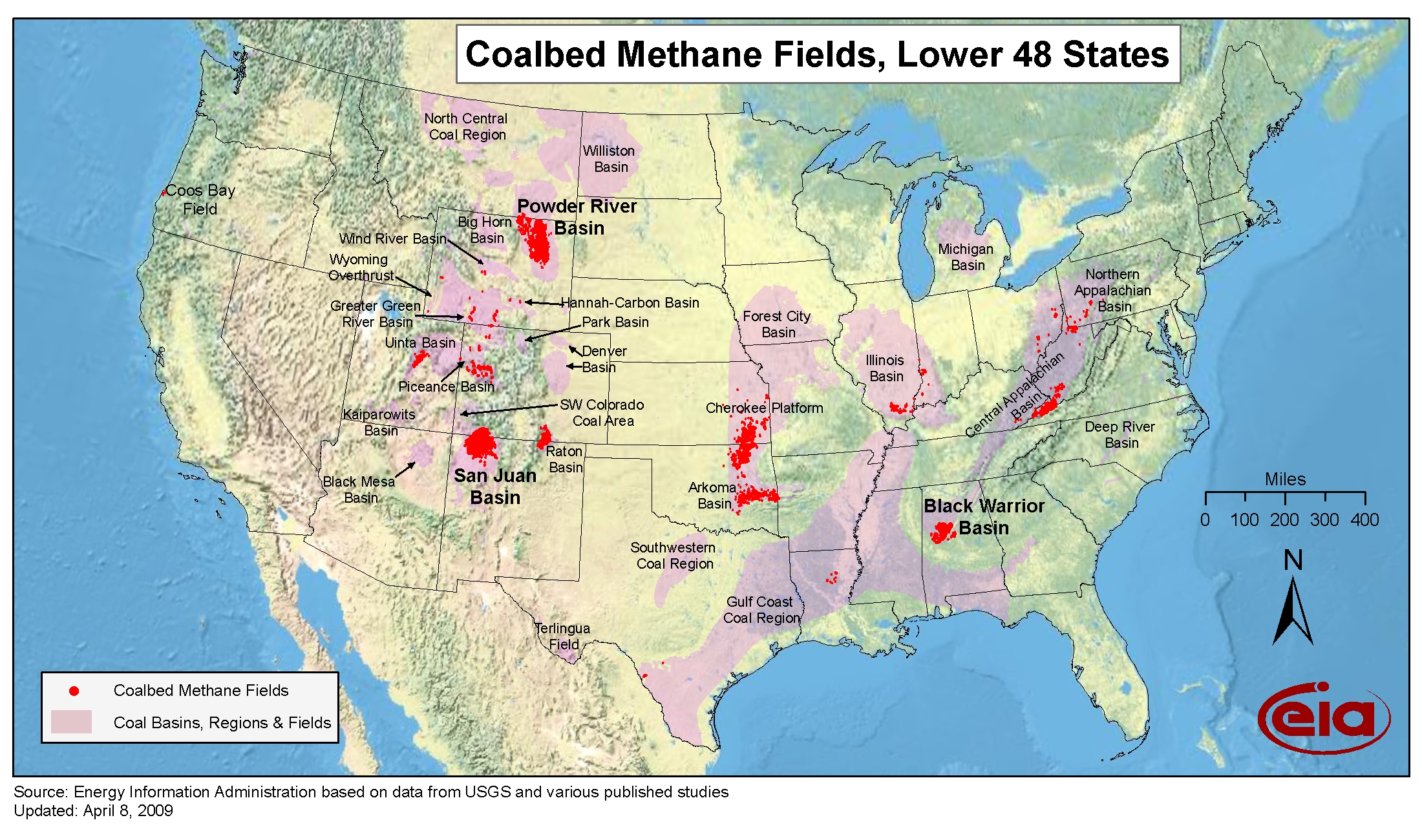
- Coalbed methane fields, Lower 48 States
-
- Panel 1: Coalbed methane status map (large format 60"x36")
-
- Panel 2: Coalbed Methane Past, Present, and Future (large format, 36" x 24")
- Map data
-
- Field boundaries (2007), resources (2006), reserves and production (2006), and top 100 methane emitting coal mines (2005)
Application of the decision procedure specified in the Federal Geographic Data Committee's Guidelines for Providing Appropriate Access to Geospatial Data in Response to Security Concerns to the geospatial data provided via this web page resulted in a finding that safeguarding of these data is unwarranted.
Interactive U.S. maps
-
Today in Energy
Energy Analysis Every Weekday -
p>
- EIA refines estimates for Permian tight oil and shale gas production
- March 17, 2026
- U.S. shale natural gas production has declined so far in 2024
- October 24, 2024
- China extracts commercially viable natural gas from deeper shale formations
- September 30, 2024
- All 74 related articles