Oil and Natural Gas Exploration, Resources, and Production
North America and U.S. Lower 48 States Maps
Maps
- Shale gas and oil plays, Lower 48 States
- Shale gas and oil plays, Lower 48 States
- Lower 48 states shale plays
- Shale gas and oil plays, North America
- Major tight gas plays, Lower 48 States
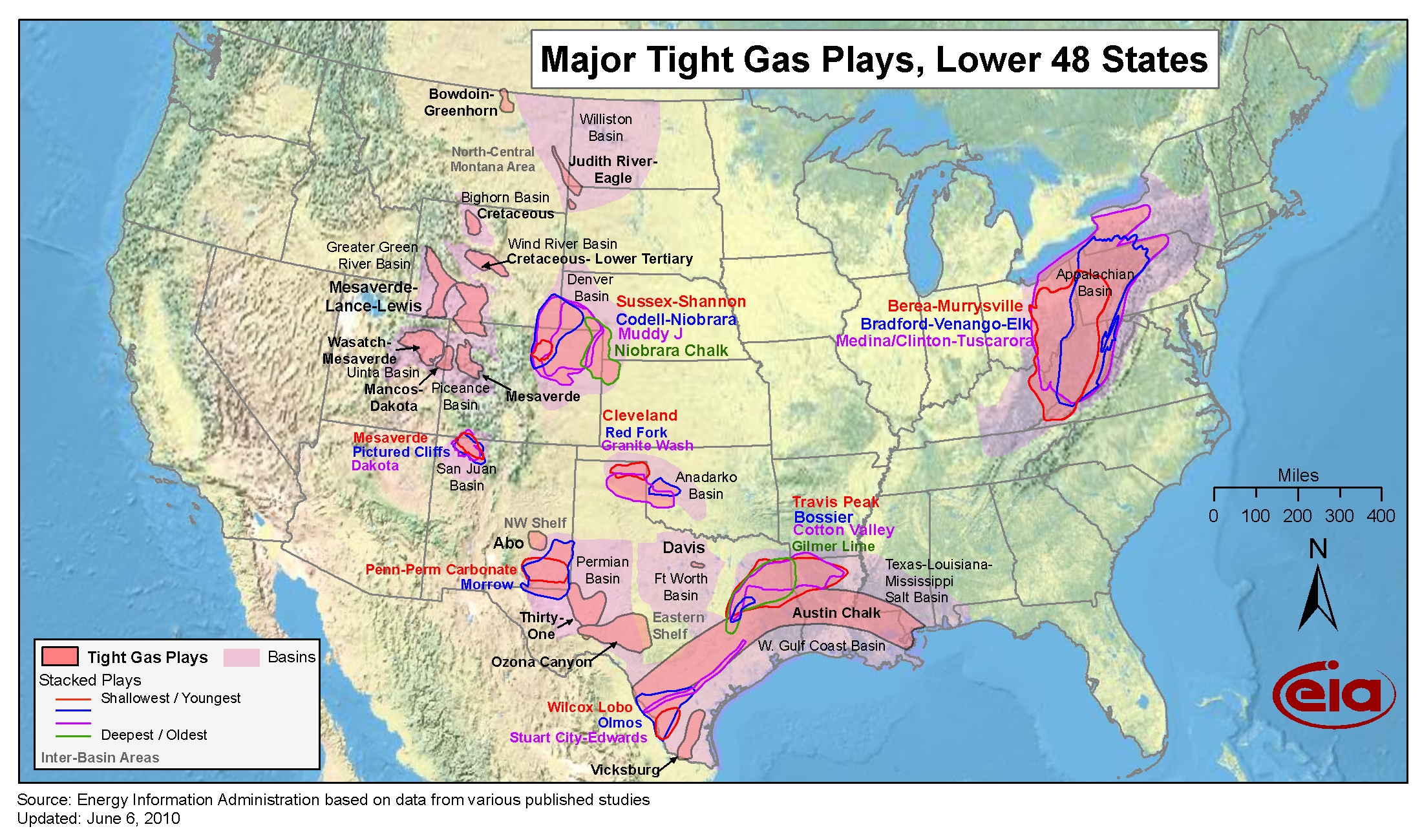
- Map data
-
- Low permeability oil and natural gas play boundaries in Lower 48 States
-
- Sedimentary basin boundaries in Lower 48 States
Major U.S. oil and natural gas play maps and reports
Description
- The following maps show the drilling history and oil and natural gas production of selected, continuous-type low-permeability reservoirs. Selected geologic characteristics pertinent to occurrence of producible oil and natural gas resources are also shown when available.
Anadarko Basin, OK and TX
- Granite Wash Play
- Woodford Shale Play
Ardmore Basin, OK and TX
- Woodford Shale Play
Arkoma Basin, OK and AR
- Fayetteville Shale, Arkansas
- Woodford Shale Play, Oklahoma
Appalachian Basin, NY, PA, OH, WV, and KY
- Marcellus Play
-
- Marcellus Play Report: geology review and map updates
-
- Marcellus Play updates
-
- Related article — Updated geologic maps provide greater detail for Marcellus formation, Today in Energy
-
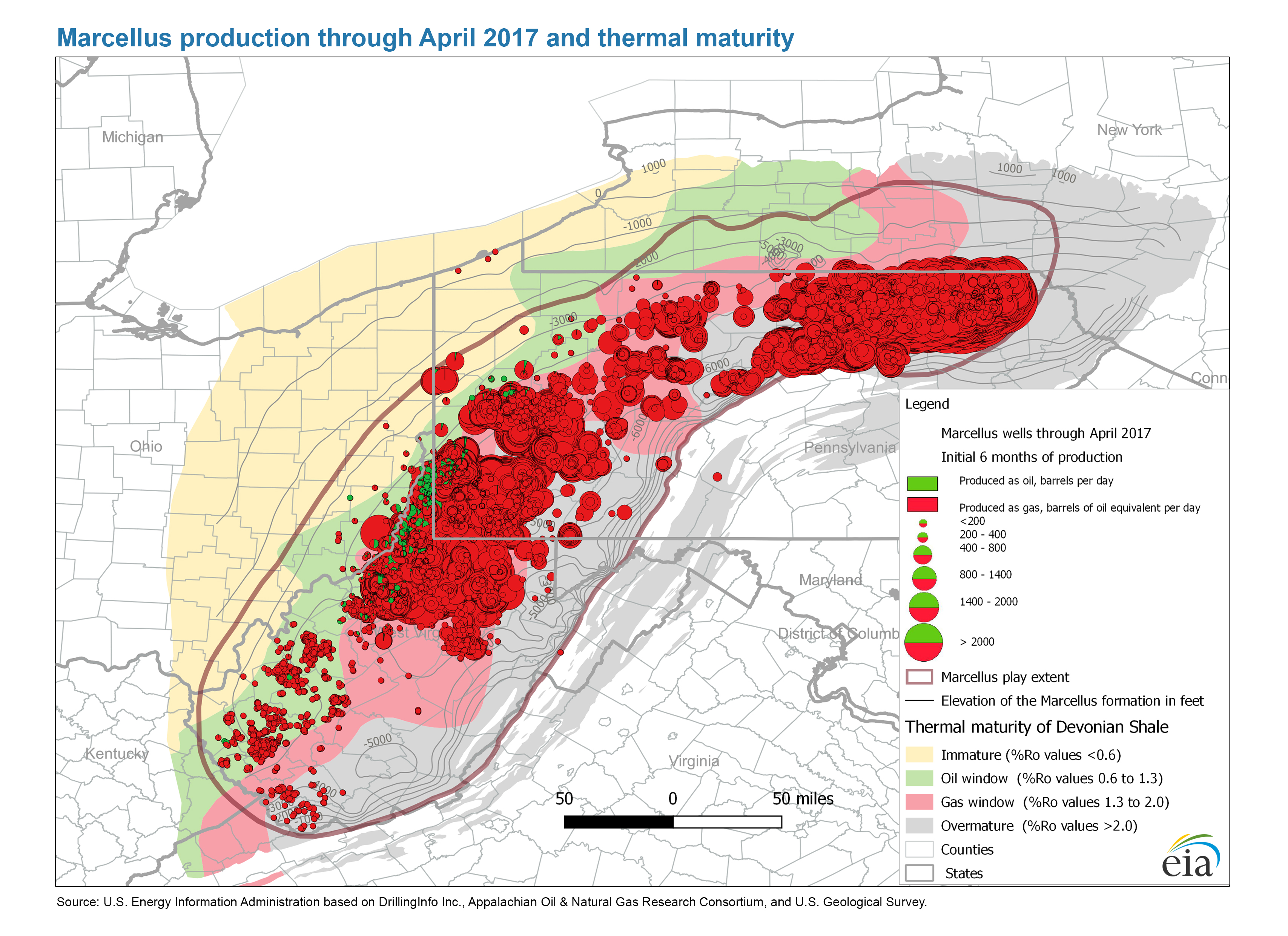
- Marcellus production through April 2017 and thermal maturity
-
- Marcellus Shale Play, Appalachian Basin
-
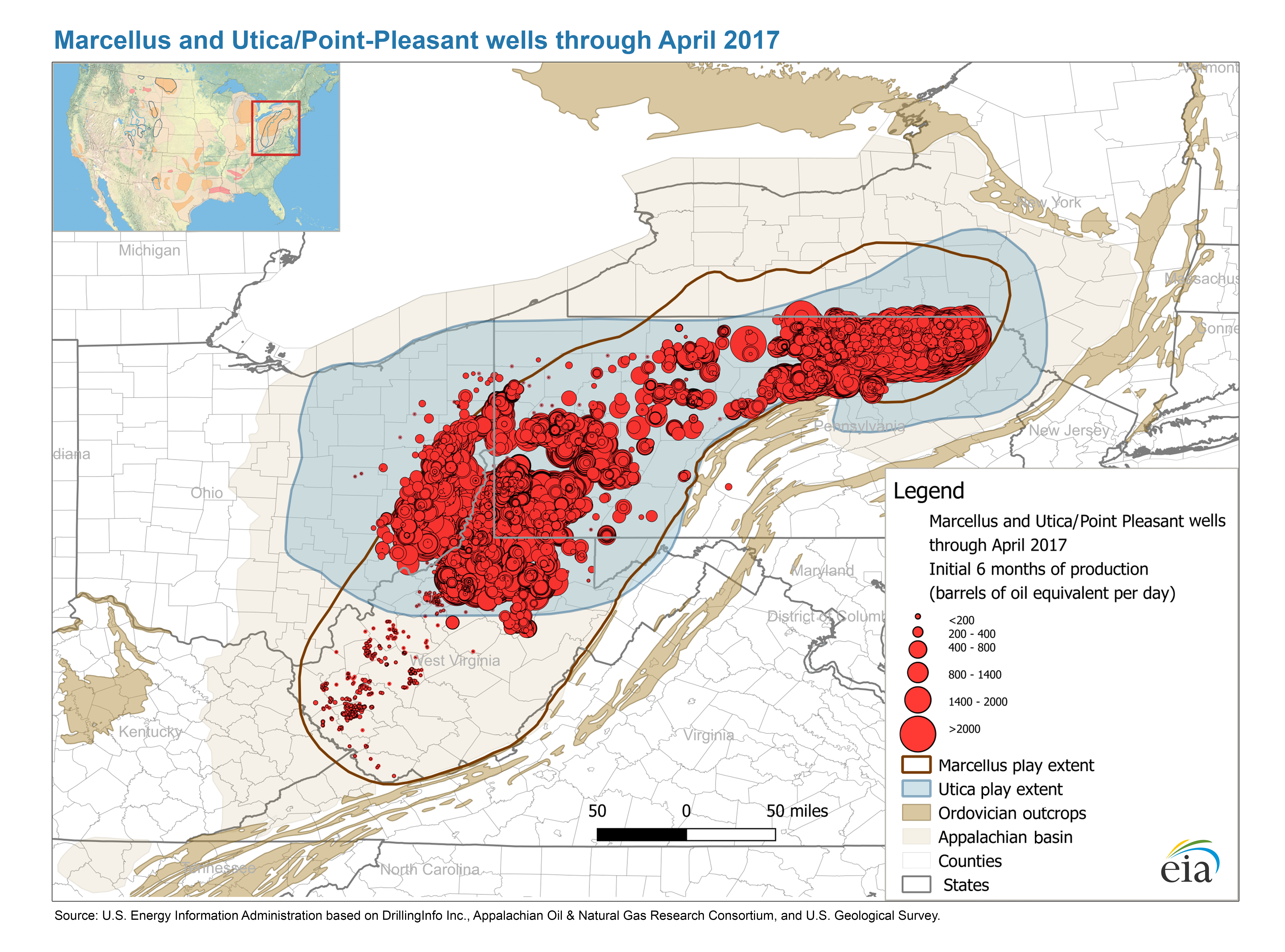
- Marcellus and Utica/Point-Pleasant wells through April 2017
- Map data
-
- Marcellus play boundaries, structure and isopachs
- Utica/Point Pleasant Play
-
- Utica Play Report: geology review and map updates
-
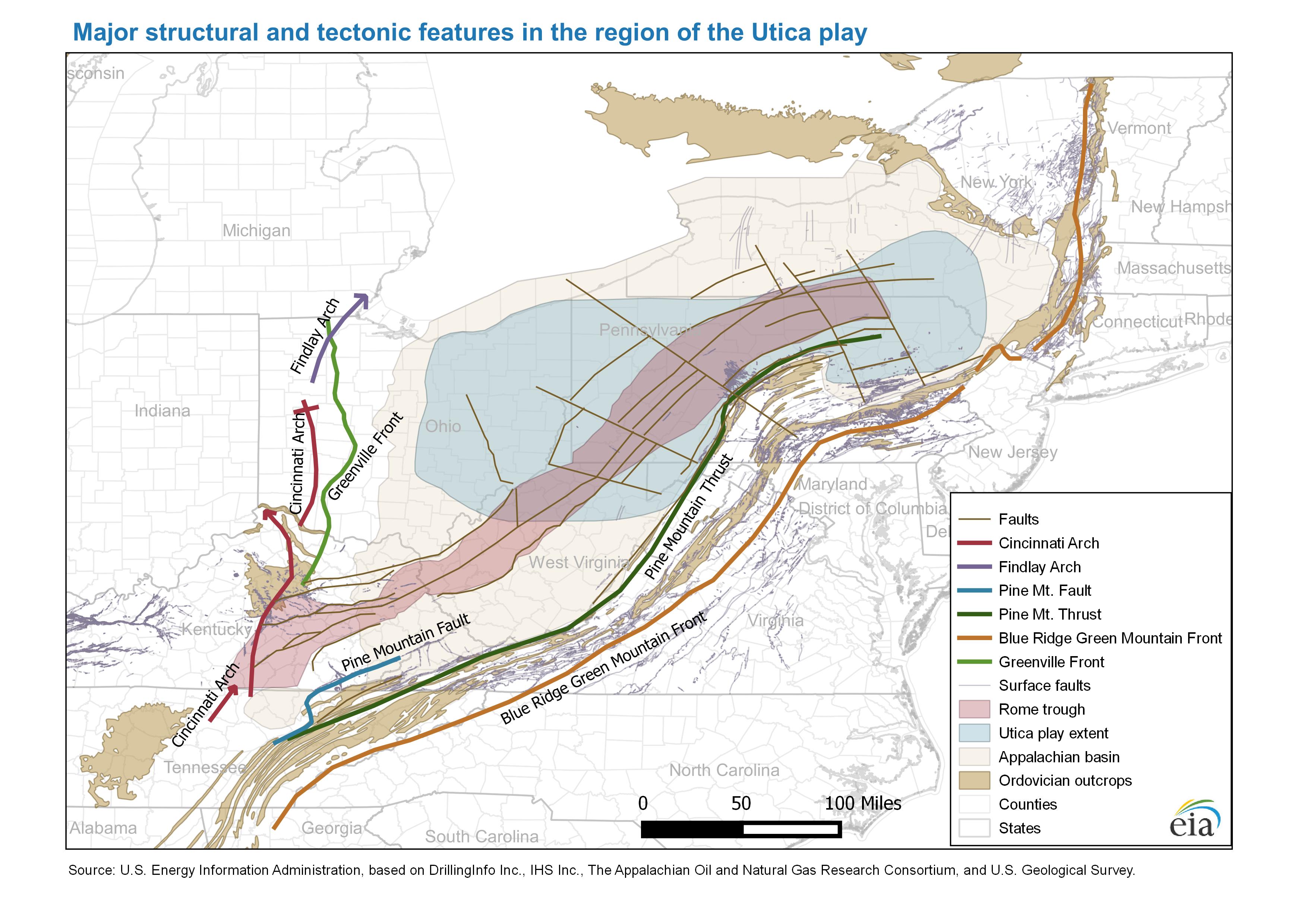
- Major structure map and tectonic features in the region of the Utica play
-
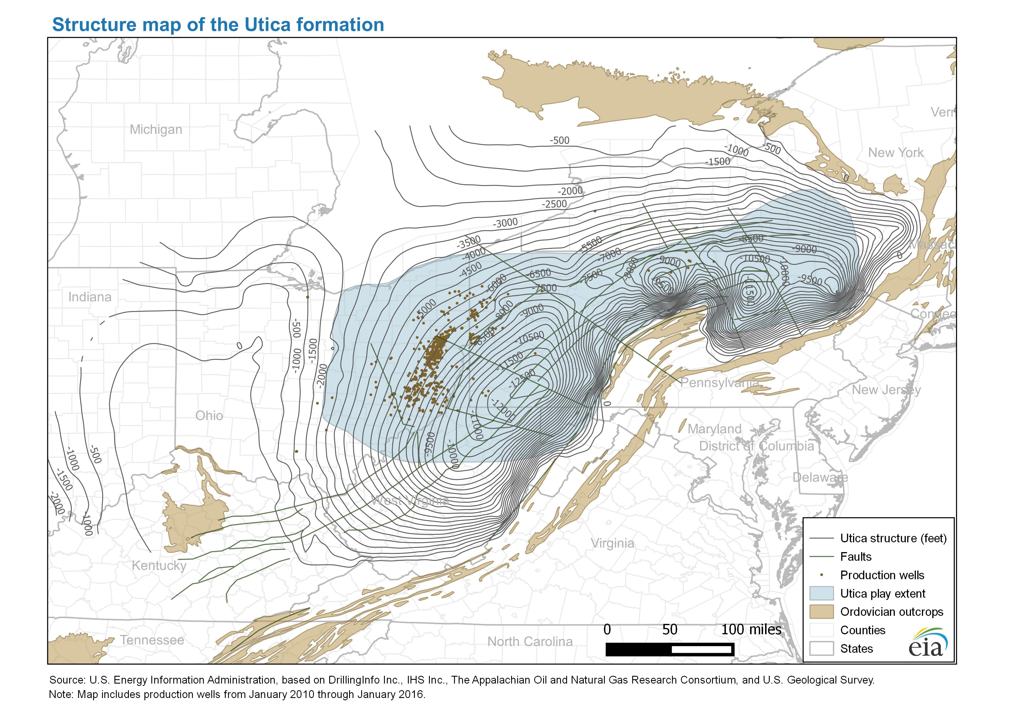
- Structure map of the Utica formation
-
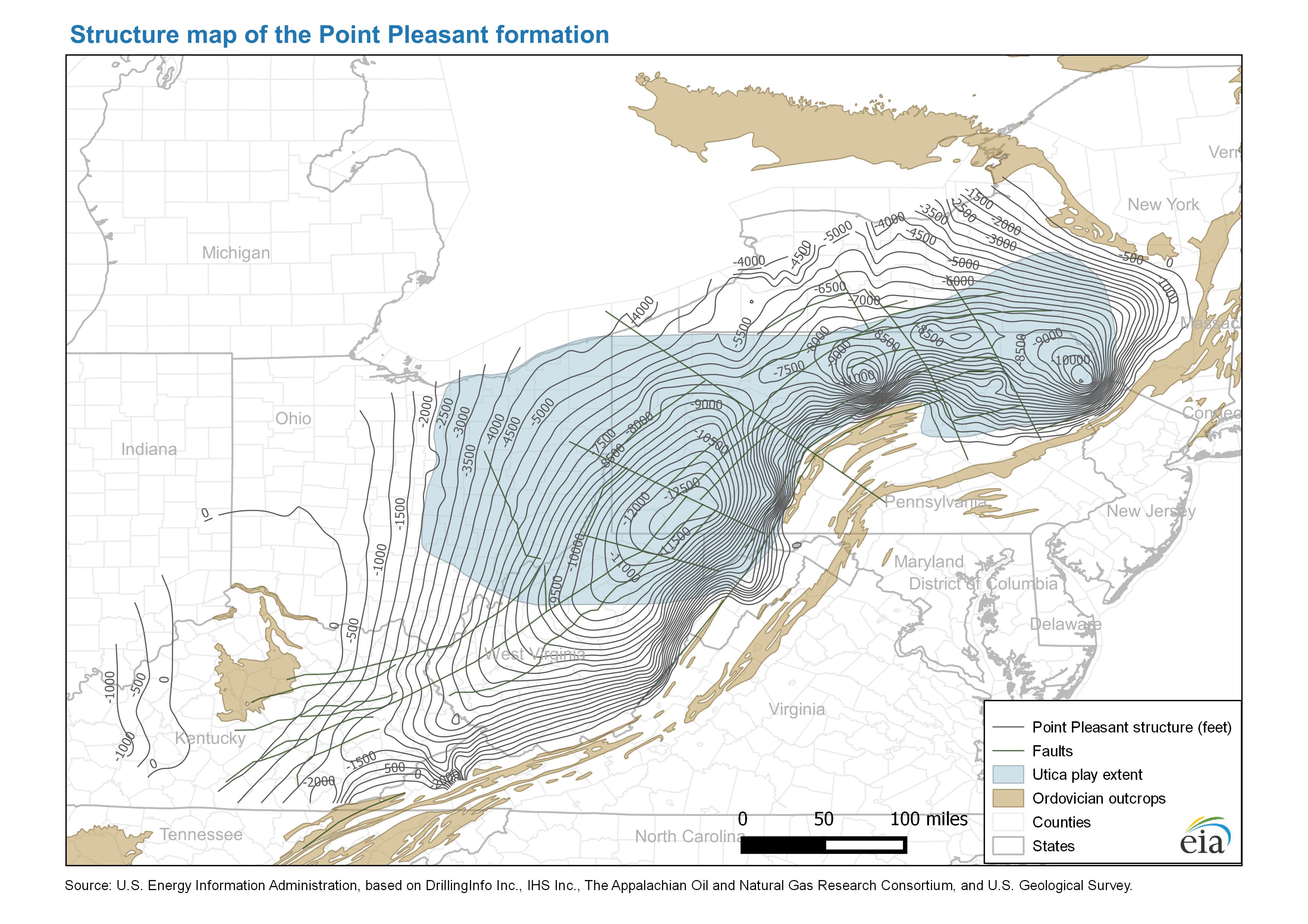
- Structure map of the Point Pleasant formation
-
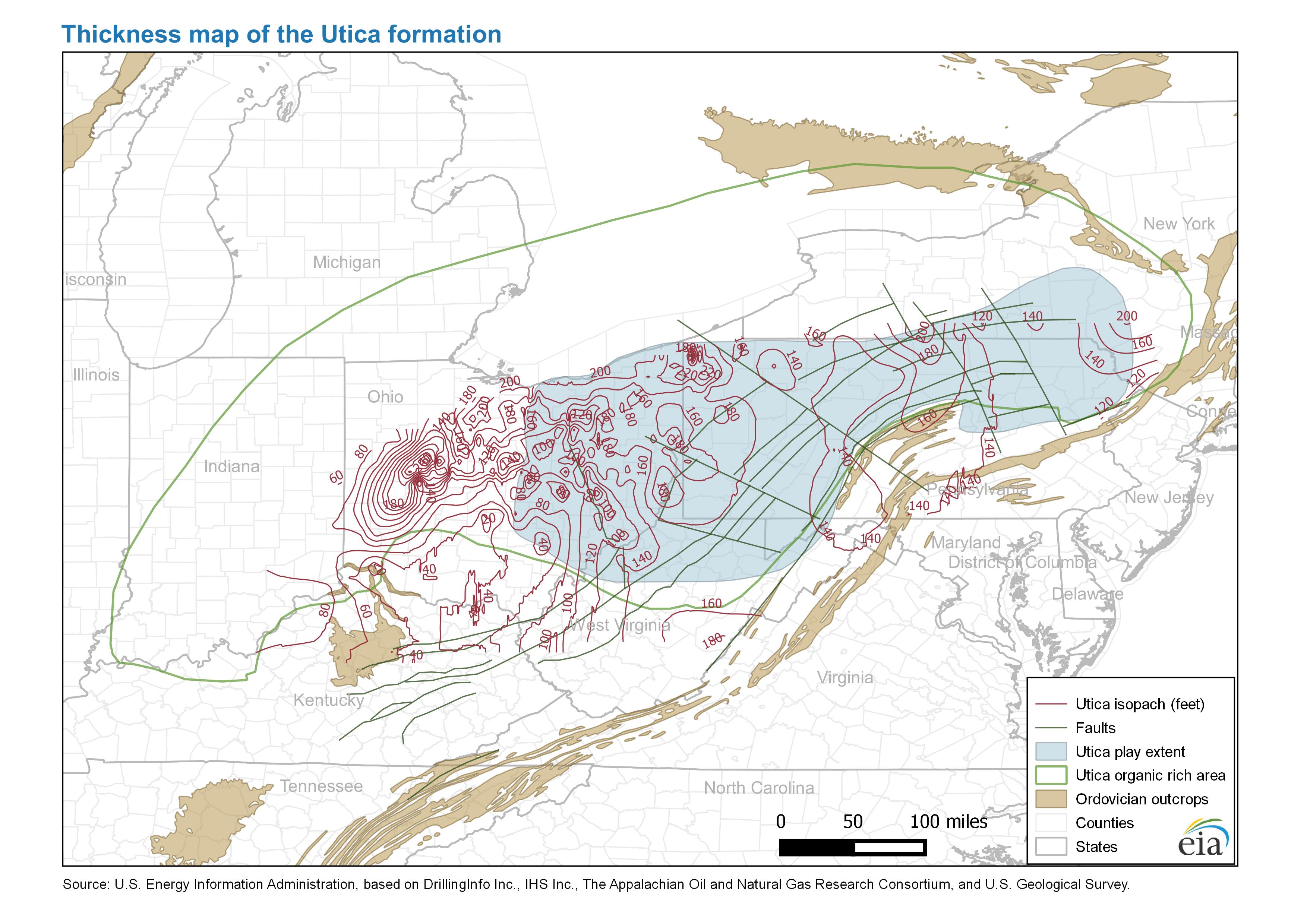
- Thickness map of the Utica formation
-
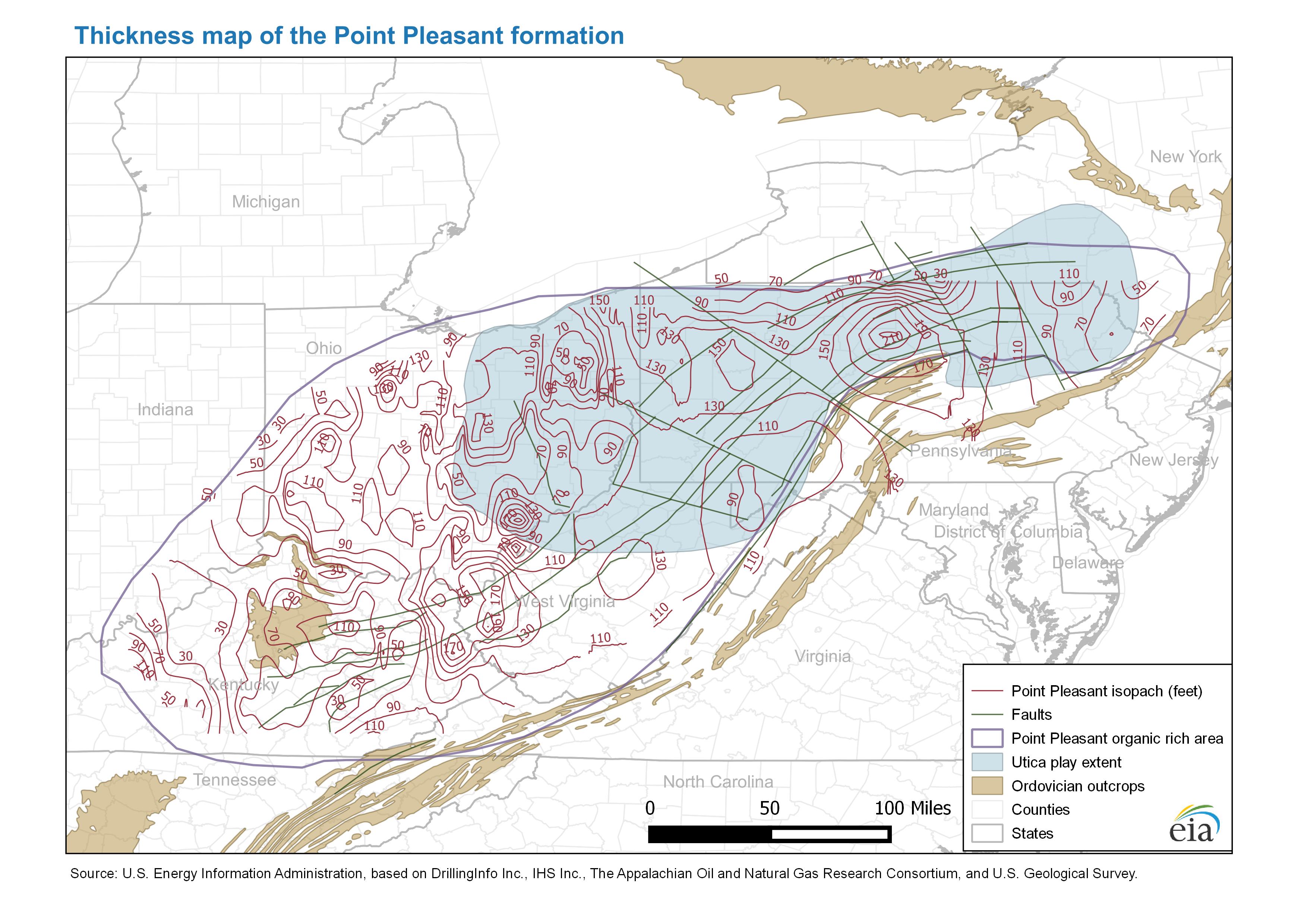
- Thickness map of the Point Pleasant formation
-
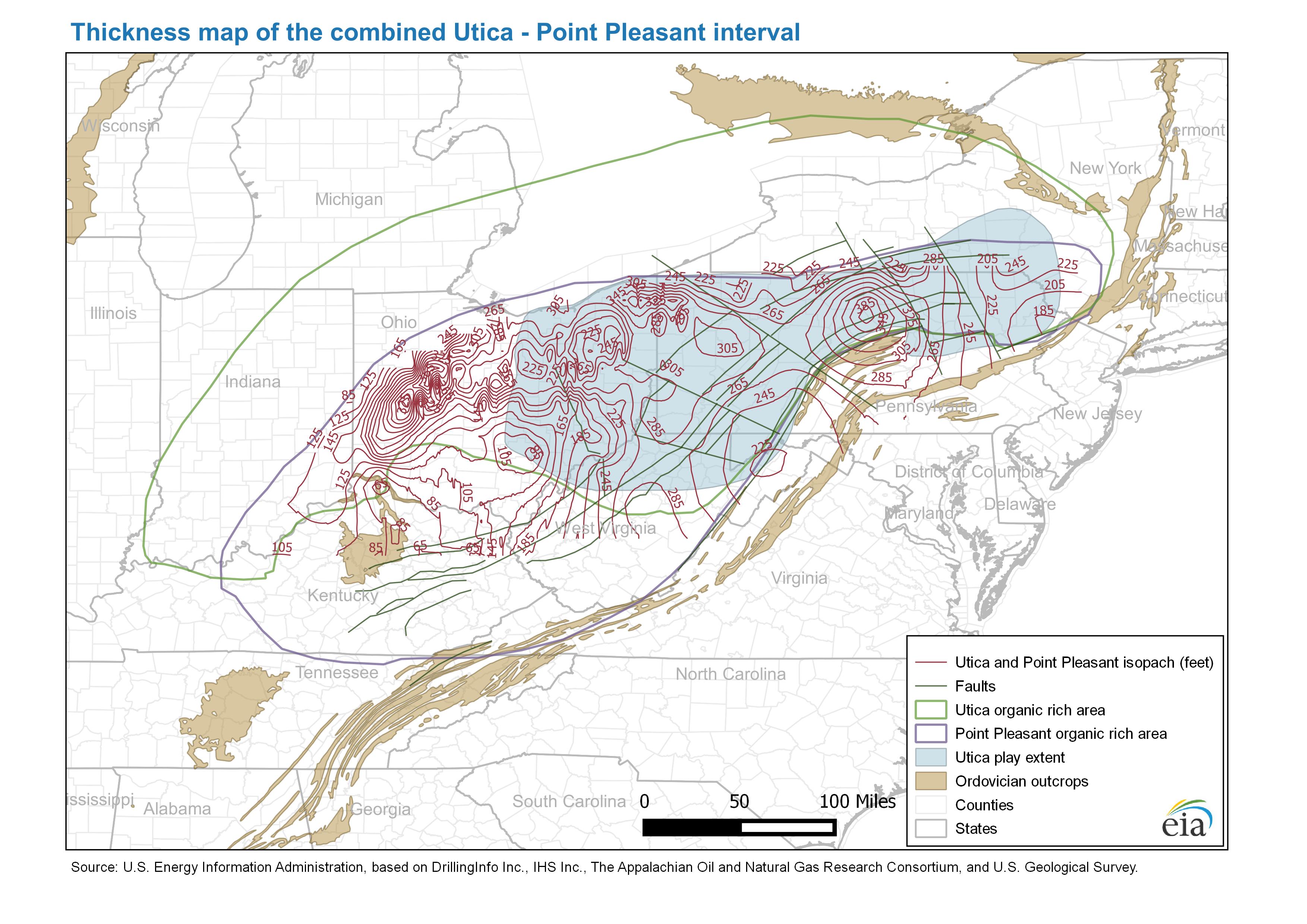
- Thickness map of the combined Utica - Point Pleasant interval
-
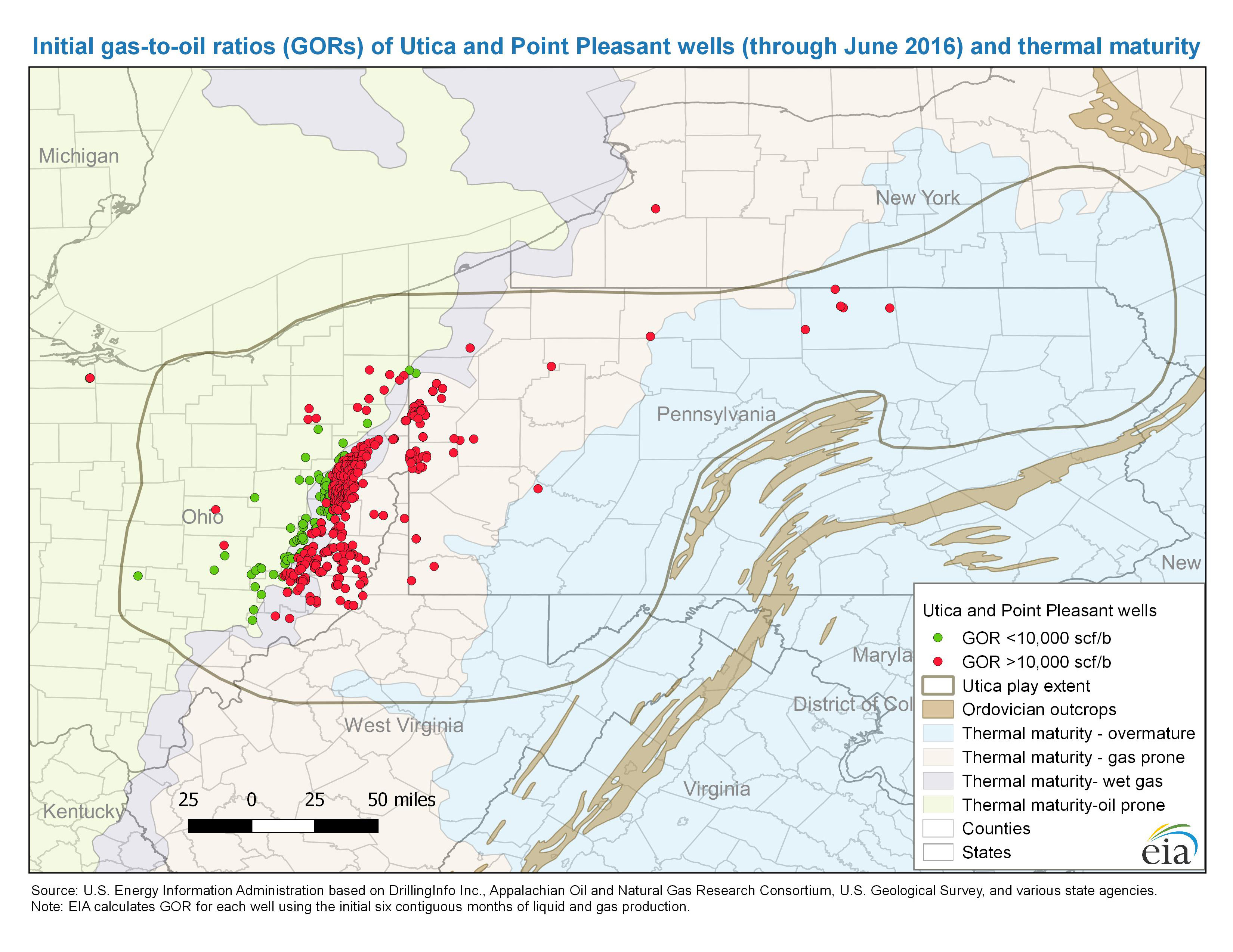
- Initial gas-to-oil ratios (GORs) of Utica and Point Pleasant wells through June 2016 and thermal maturity
-
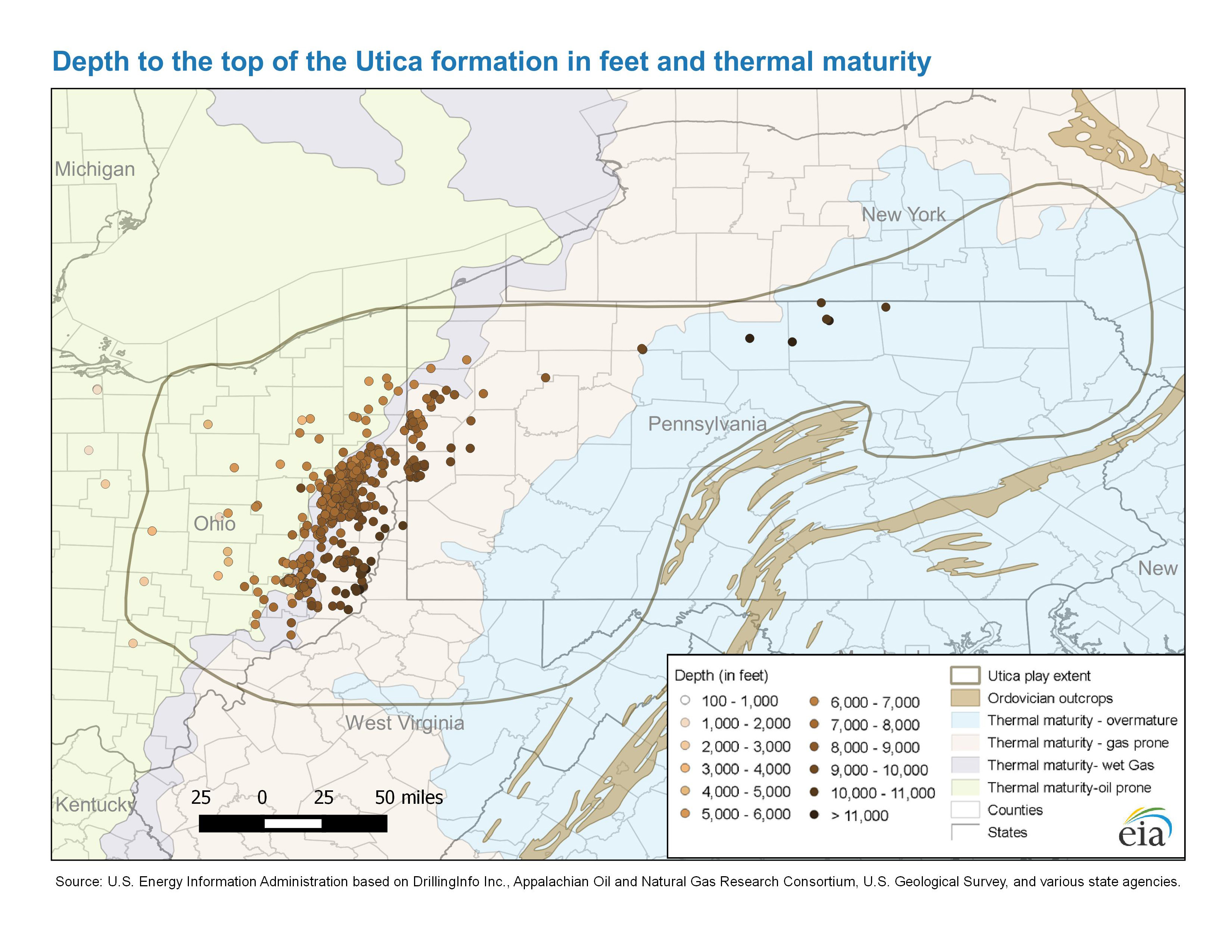
- Depth to the top of the Utica formation in feet and thermal maturity
-
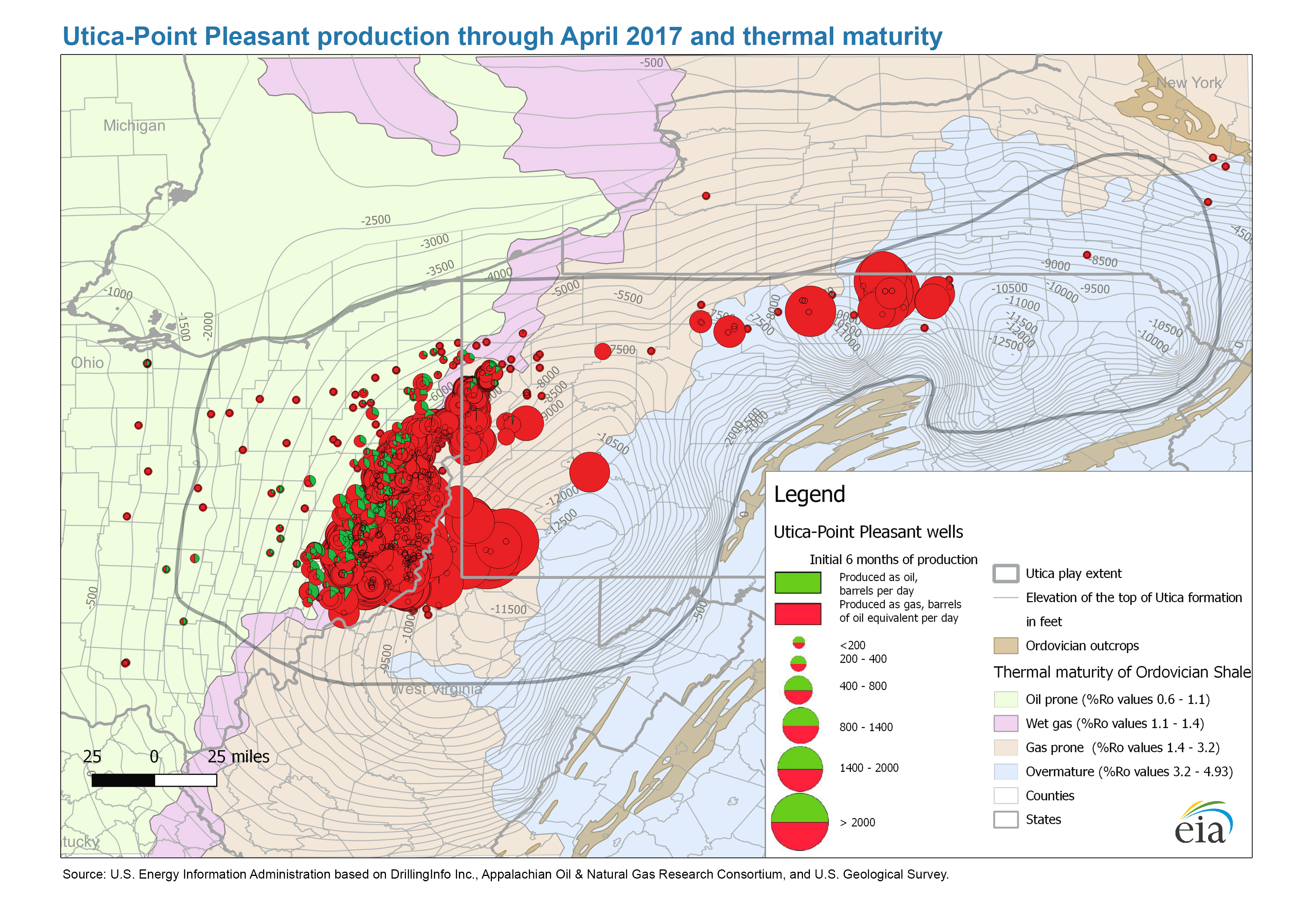
- Utica and Point Pleasant production through April 2017 and thermal maturity
-
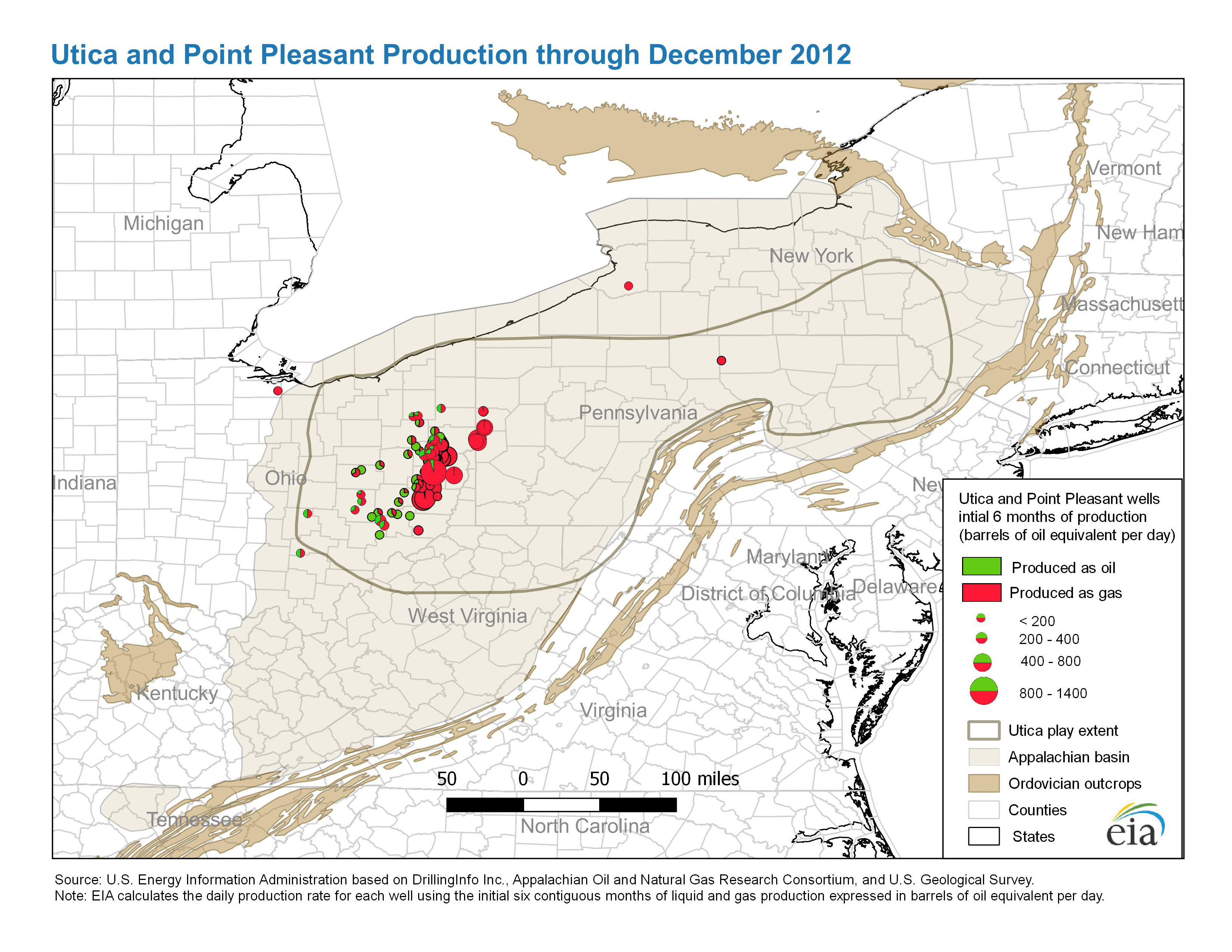
- Utica and Point Pleasant production through December 2012
-
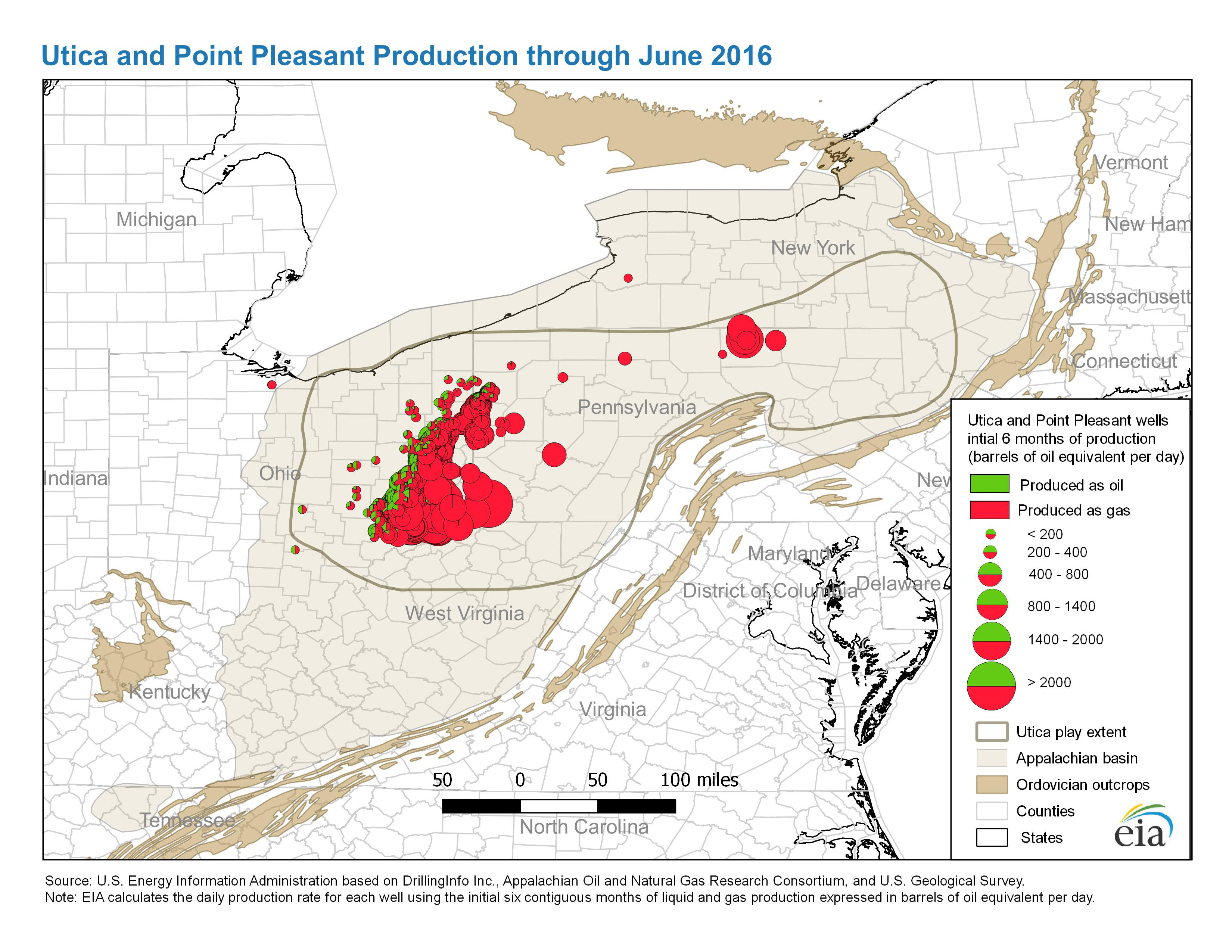
- Utica and Point Pleasant production through June 2016
- Map data
-
- Utica play: play boundaries, structure and Isopach for Utica and Point Pleasant formations
-
- Utica play: Major structural and tectonic features
Ft. Worth Basin, TX
- Barnett Shale
- History animation: Barnett Shale Drilling, 1981-2010
Permian Basin, TX and NM
-
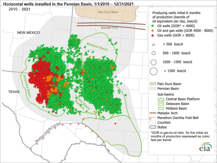
- Permian Basin production January 2010 through December 2021
Data source: U.S. Energy Information Administration, based on DrillingInfo
-
- Permian Basin: Part I: Wolfcamp, Bone Spring, Delaware Shale Plays of the Delaware Basin
-
- Permian Basin: Part II: Wolfcamp Shale and Spraberry Plays of the Midland Basin
-
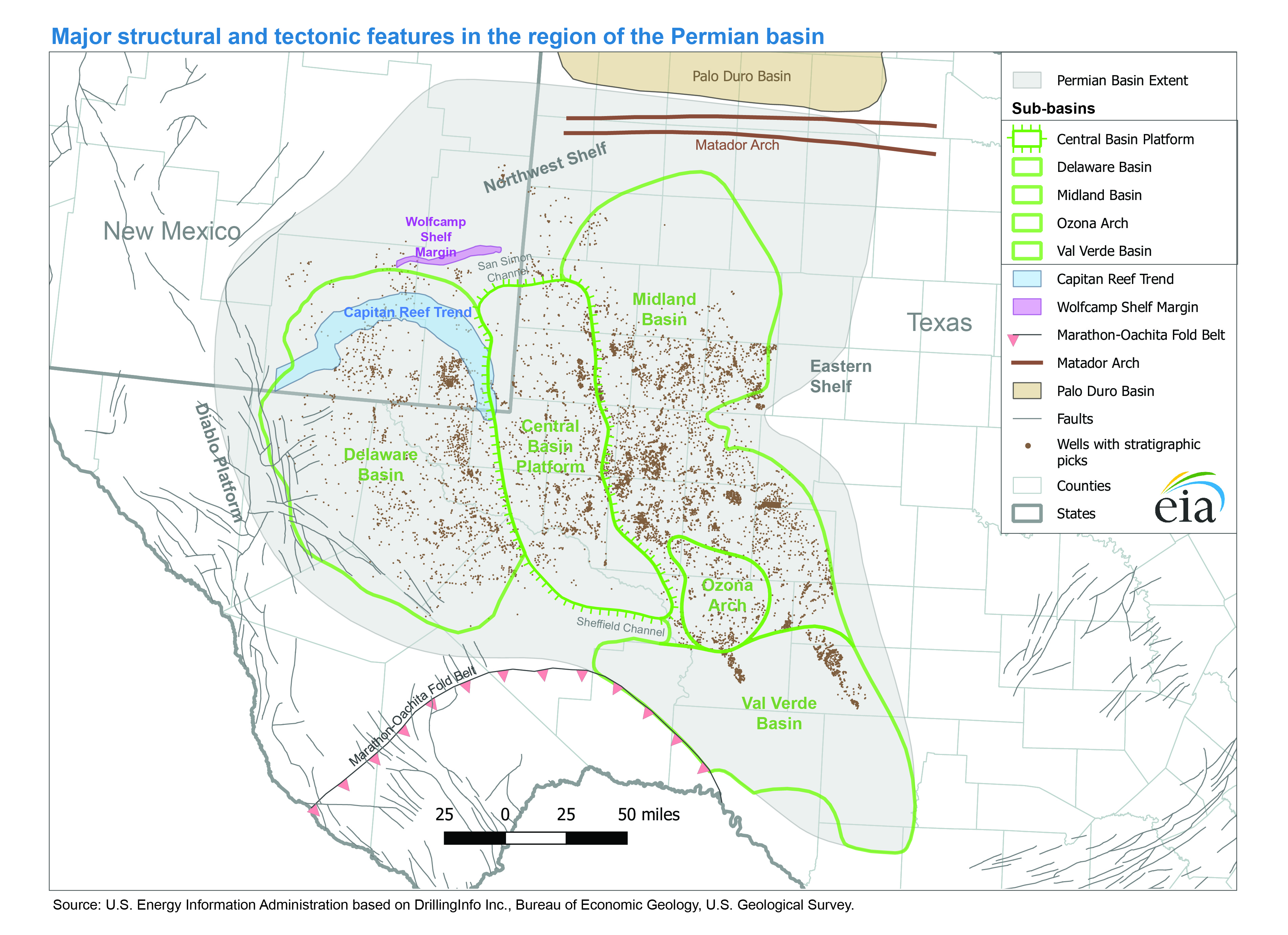
- Major structural and tectonic features of the Permian Basin
-
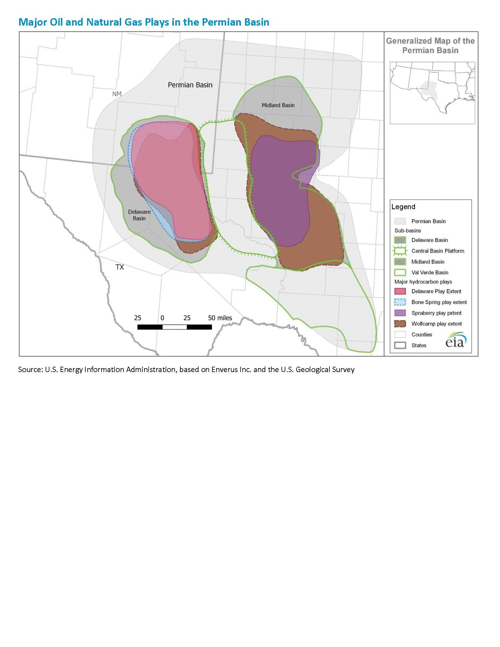
- Major oil and natural gas plays in the Permian Basin
-
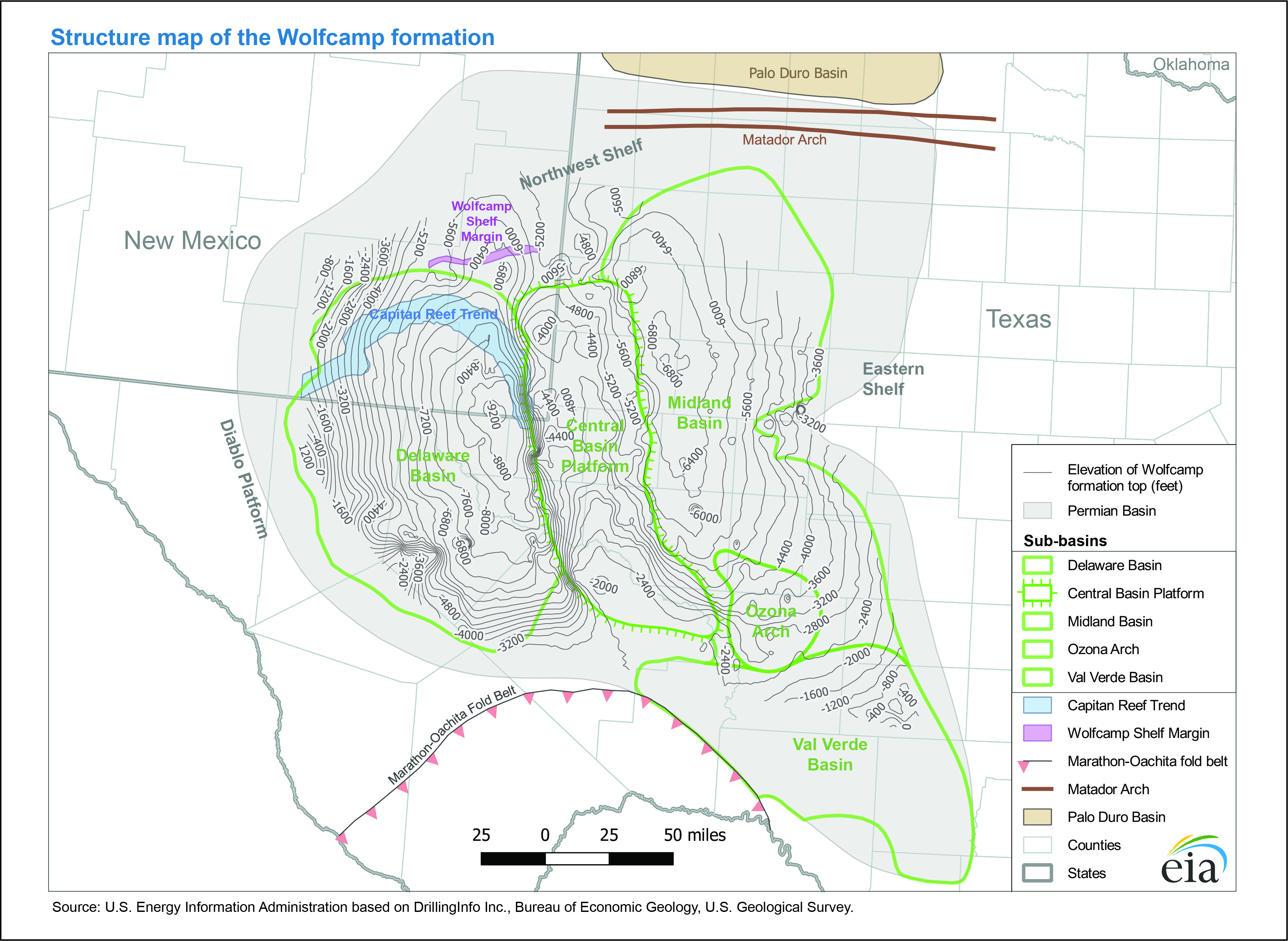
- Structure map of the Wolfcamp formation
-
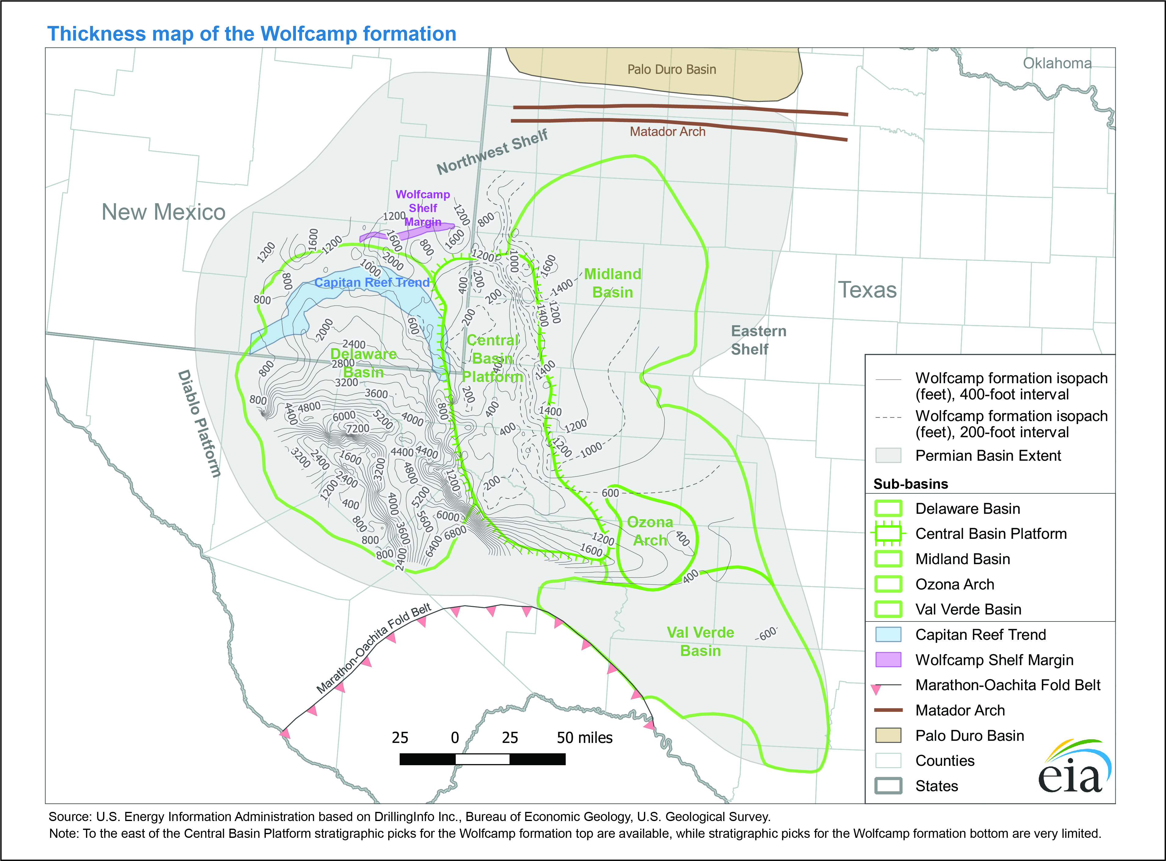
- Thickness map of the Wolfcamp formation
-
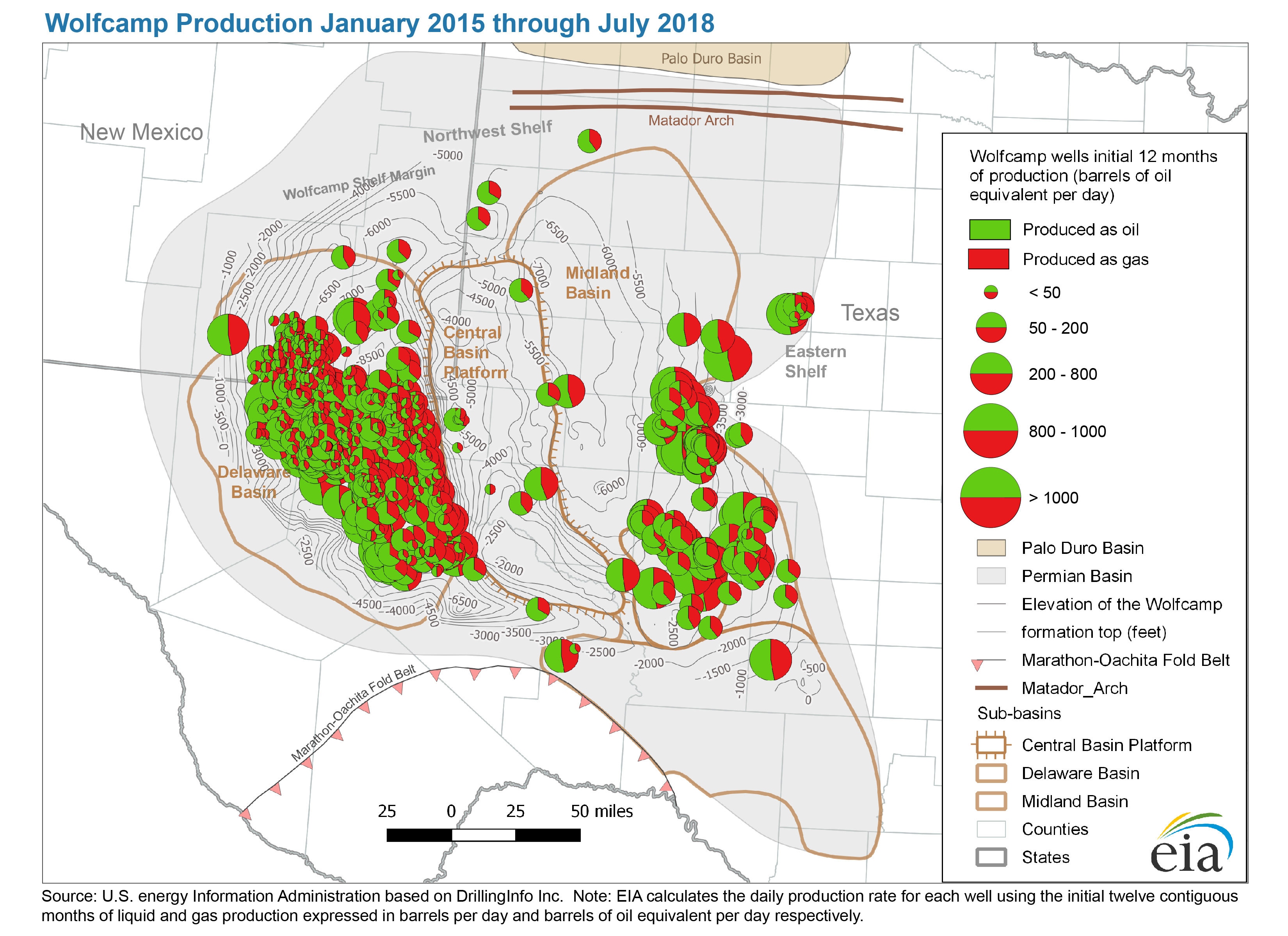
- Wolfcamp production January 2015 through July 2018
-
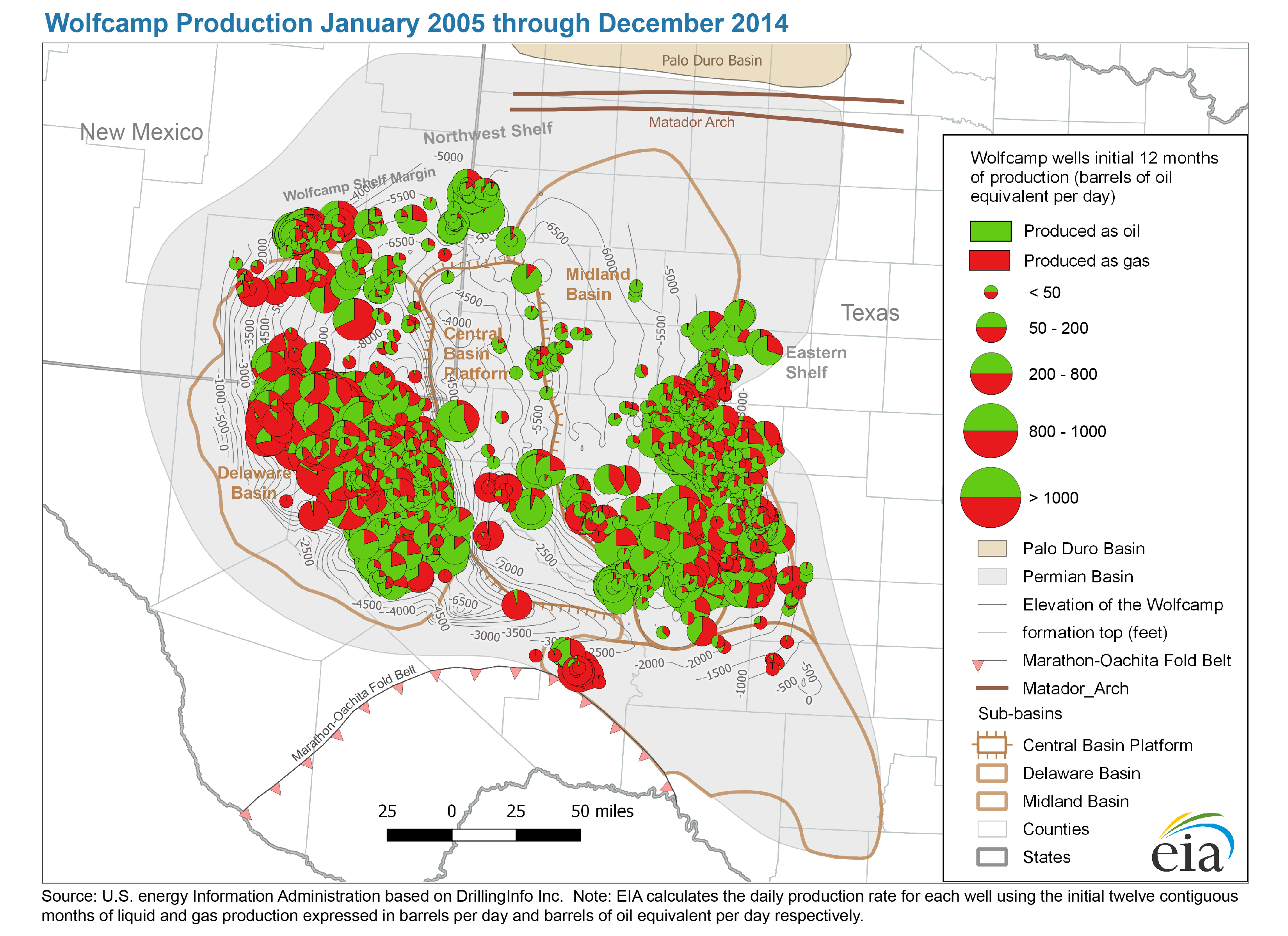
- Wolfcamp production January 2005 through December 2014
-
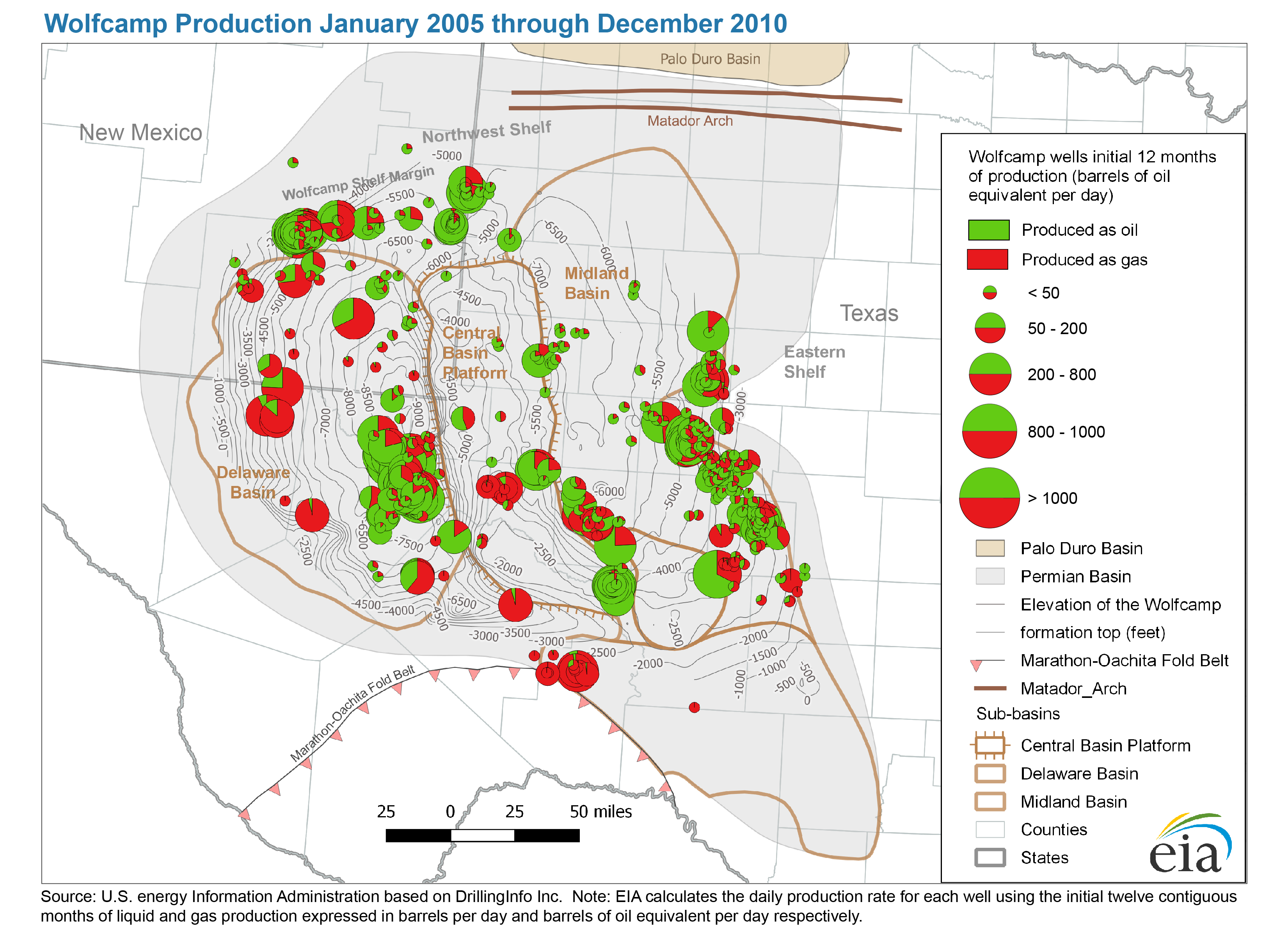
- Wolfcamp production January 2005 through December 2010
-
- Today in Energy article: The Wolfcamp play has been key to Permian Basin oil and natural gas production growth
- Map data
-
- Permian Basin: Wolfcamp formation elevation and isopachs
-
- Permian Basin, Delaware Sub-Basin: Wolfcamp play boundary
-
- Abo-Yeso, Glorieta-Yeso, and Spraberry play boundaries
-
- Permian Basin: boundary, structure and tectonic features
Delaware Subbasin, TX and NM
-
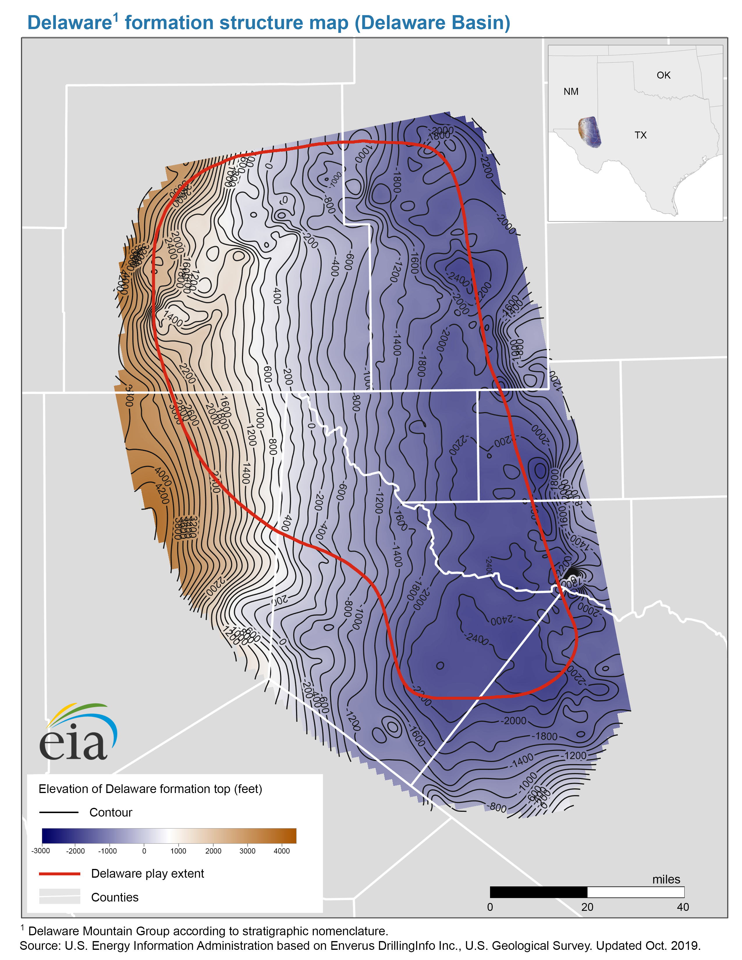
- Delaware formation structure map (Delaware Basin)
-
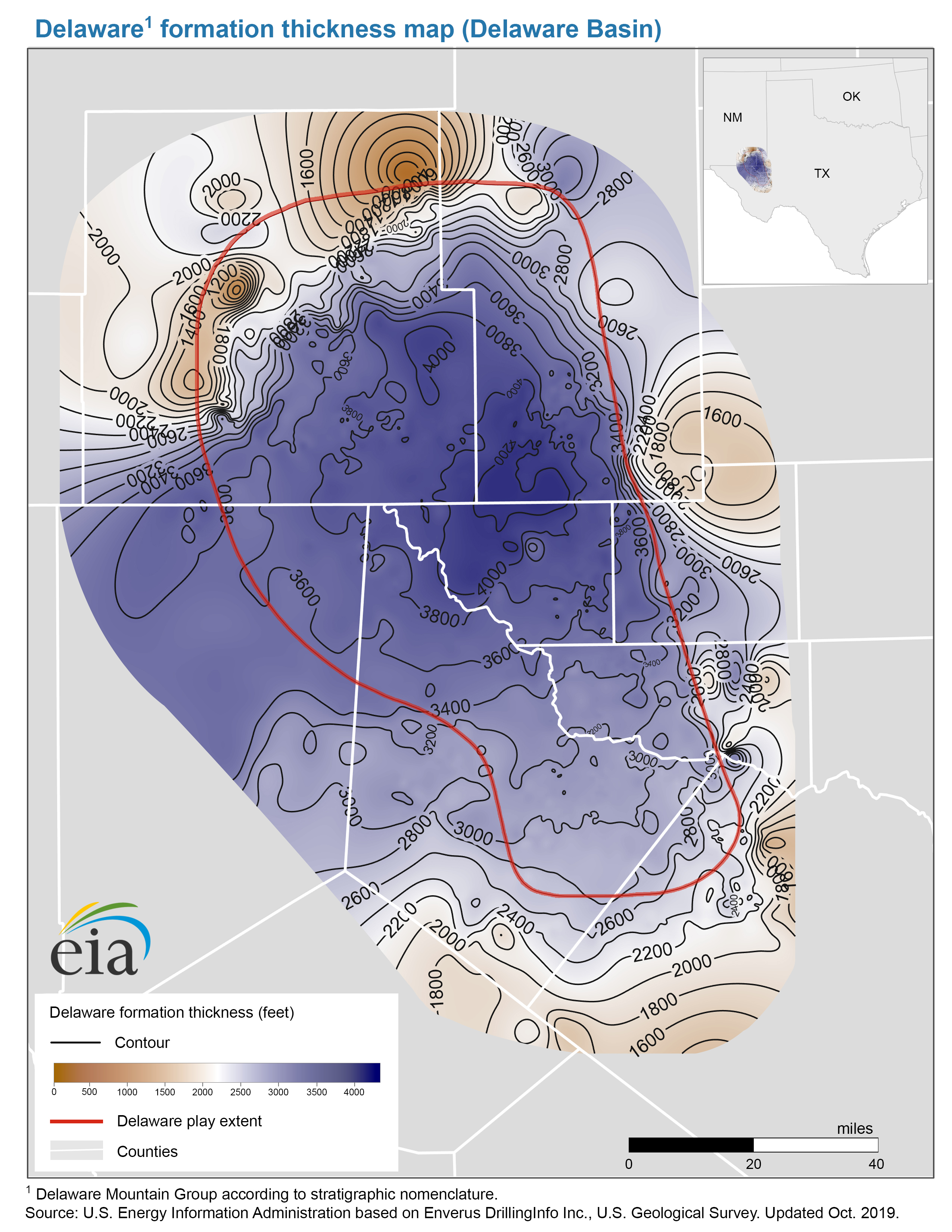
- Delaware formation thickness map (Delaware Basin)
- Map data
-
- Delaware play boundary
-
- Delaware formation structure and isopachs
- Bone Spring Play
-
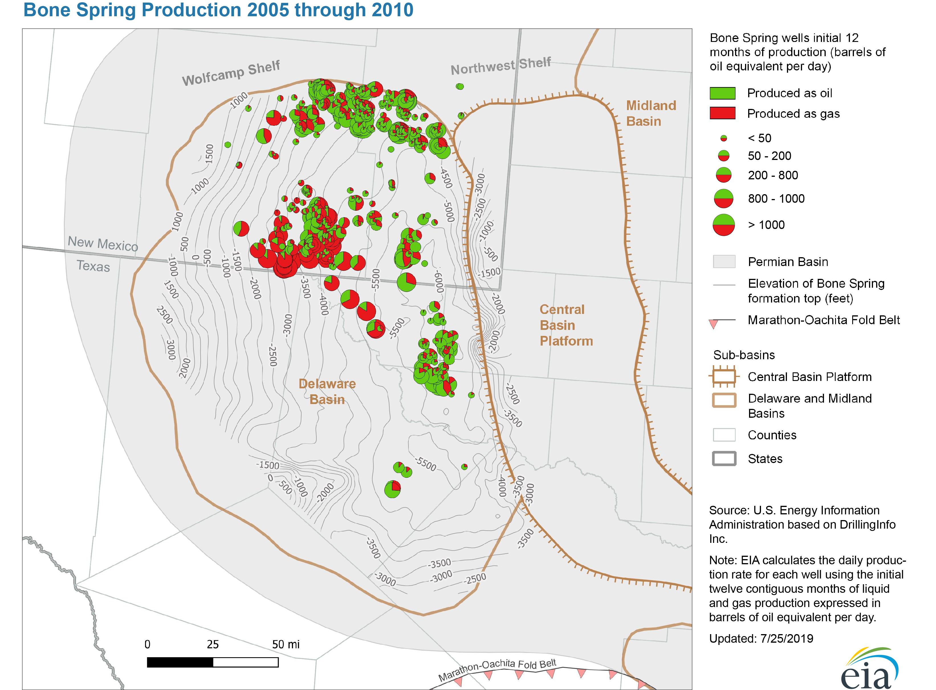
- Bone Spring Production 2005 through 2010
-
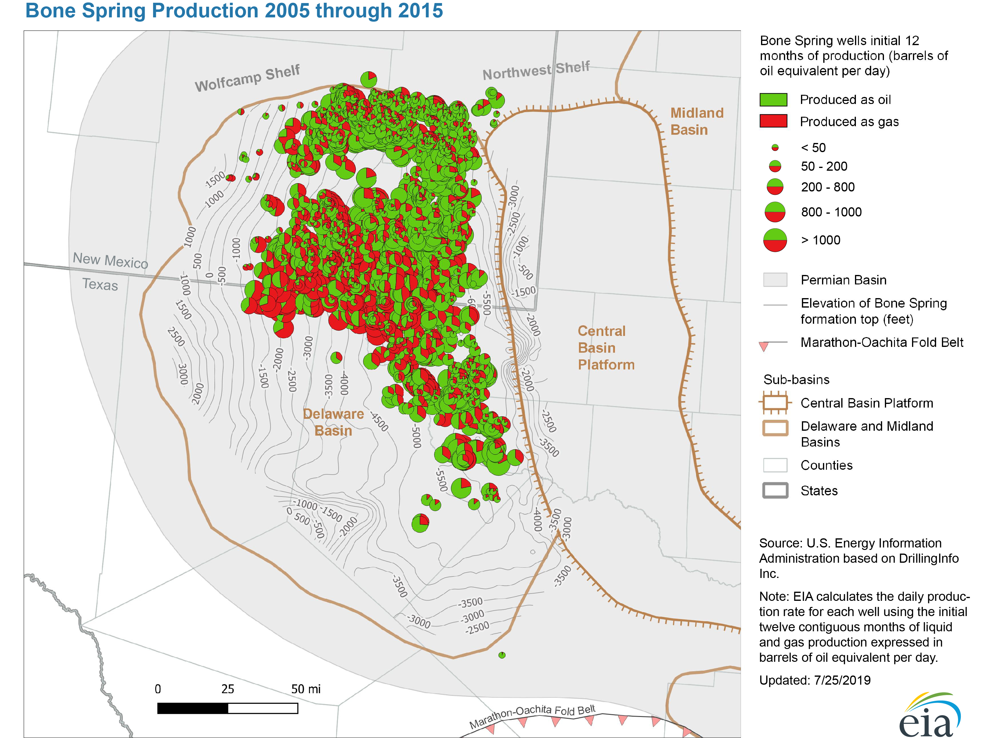
- Bone Spring Production 2005 through 2015
-
- Bone Spring Production 2005 through June 2019
-
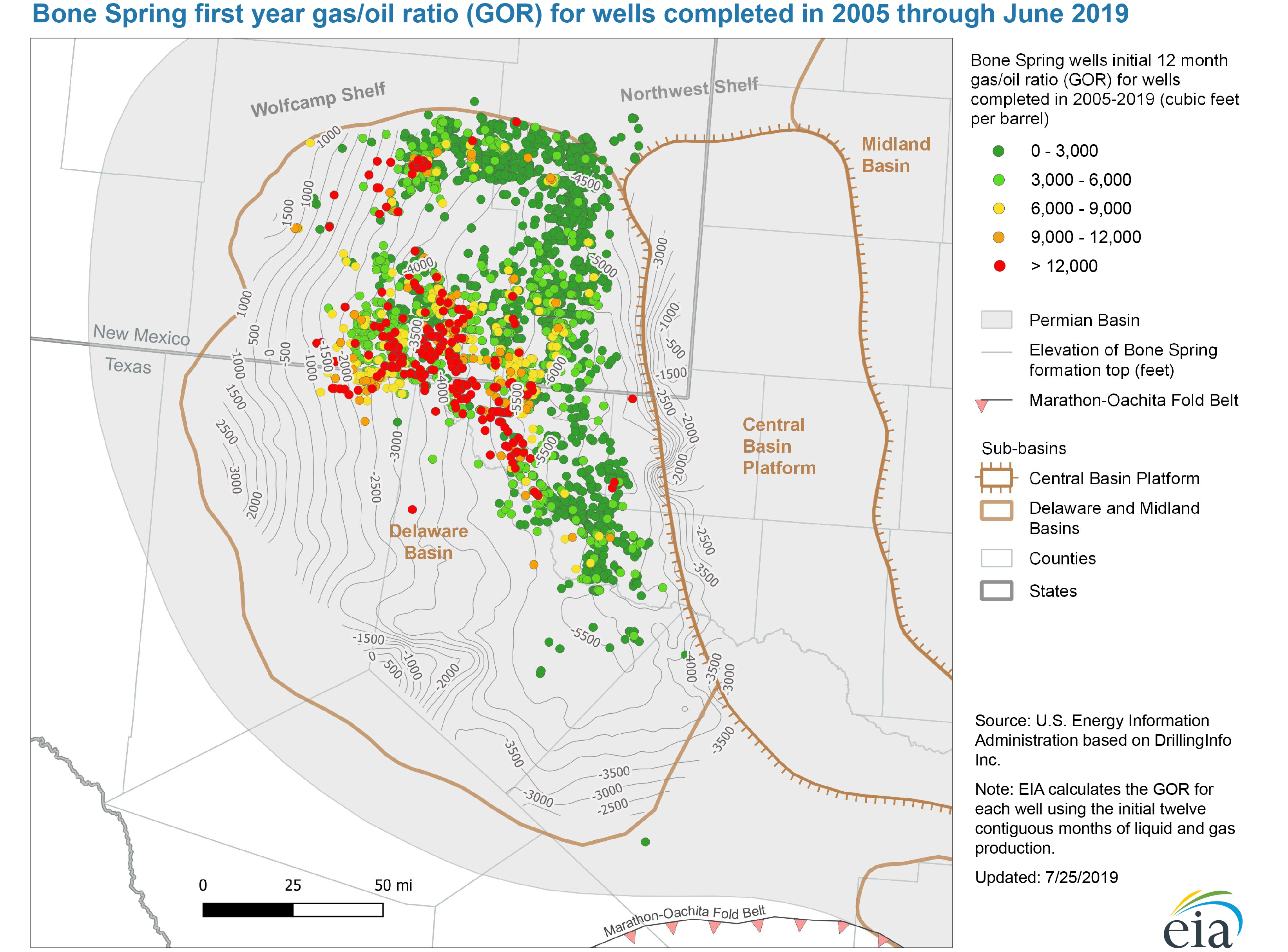
- Bone Spring first year gas/oil ratio (GOR) for wells completed 2005 through June 2019
-
- Structure map of the Avalon Bone Spring formation, Delaware Basin
-
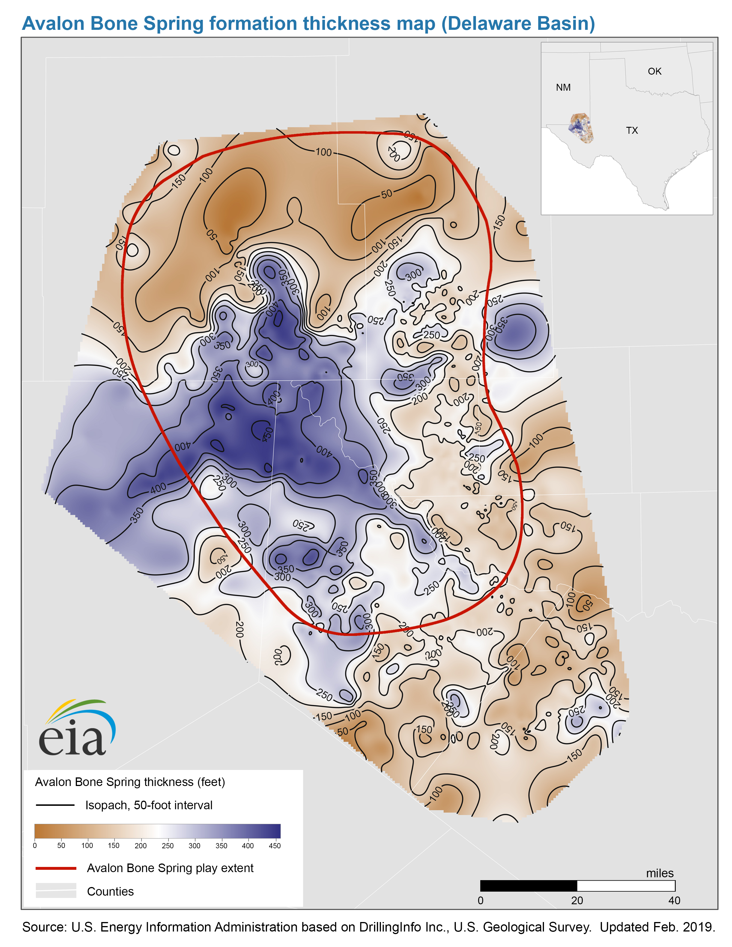
- Thickness map of the Avalon Bone Spring formation, Delaware Basin
-
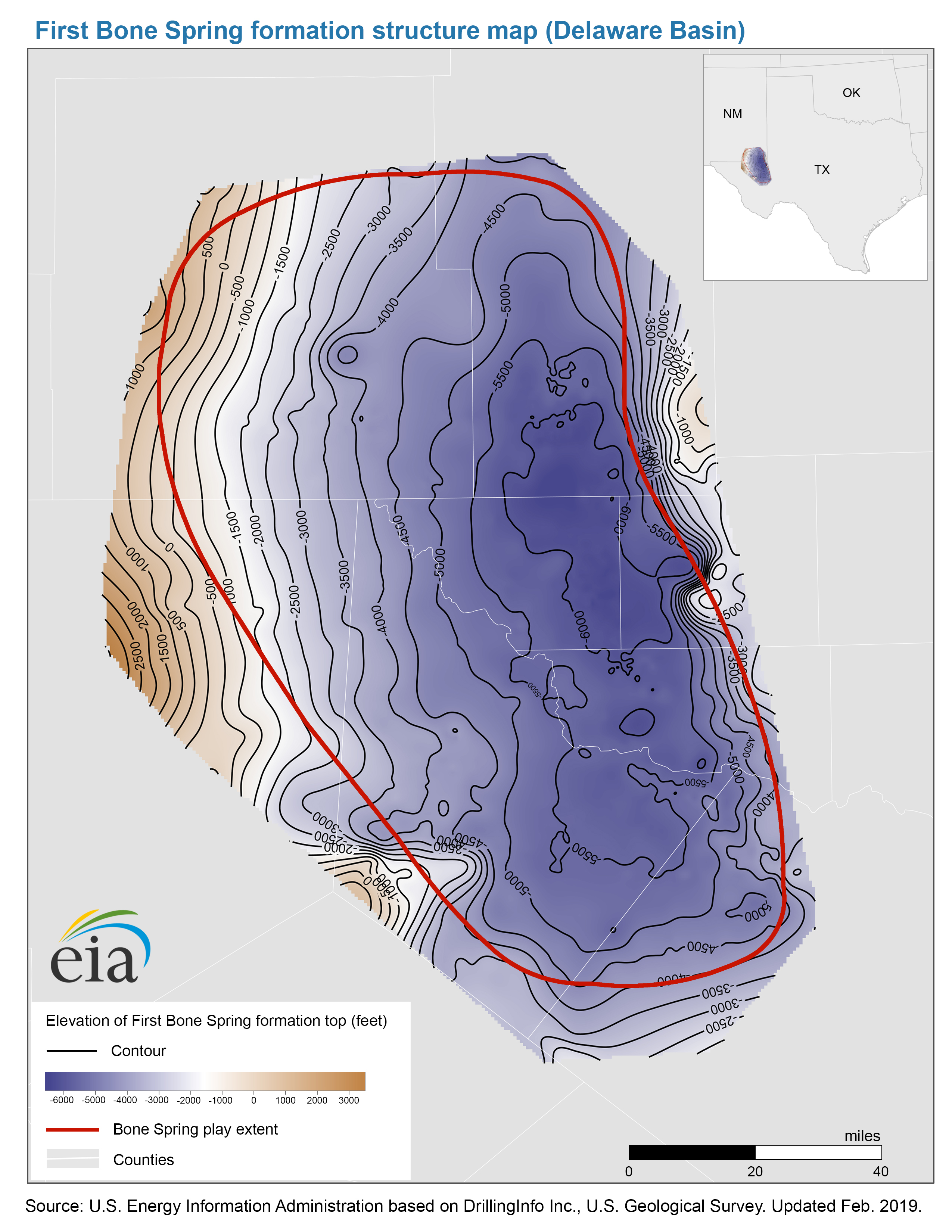
- Structure map of the First Bone Spring formation, Delaware Basin
-
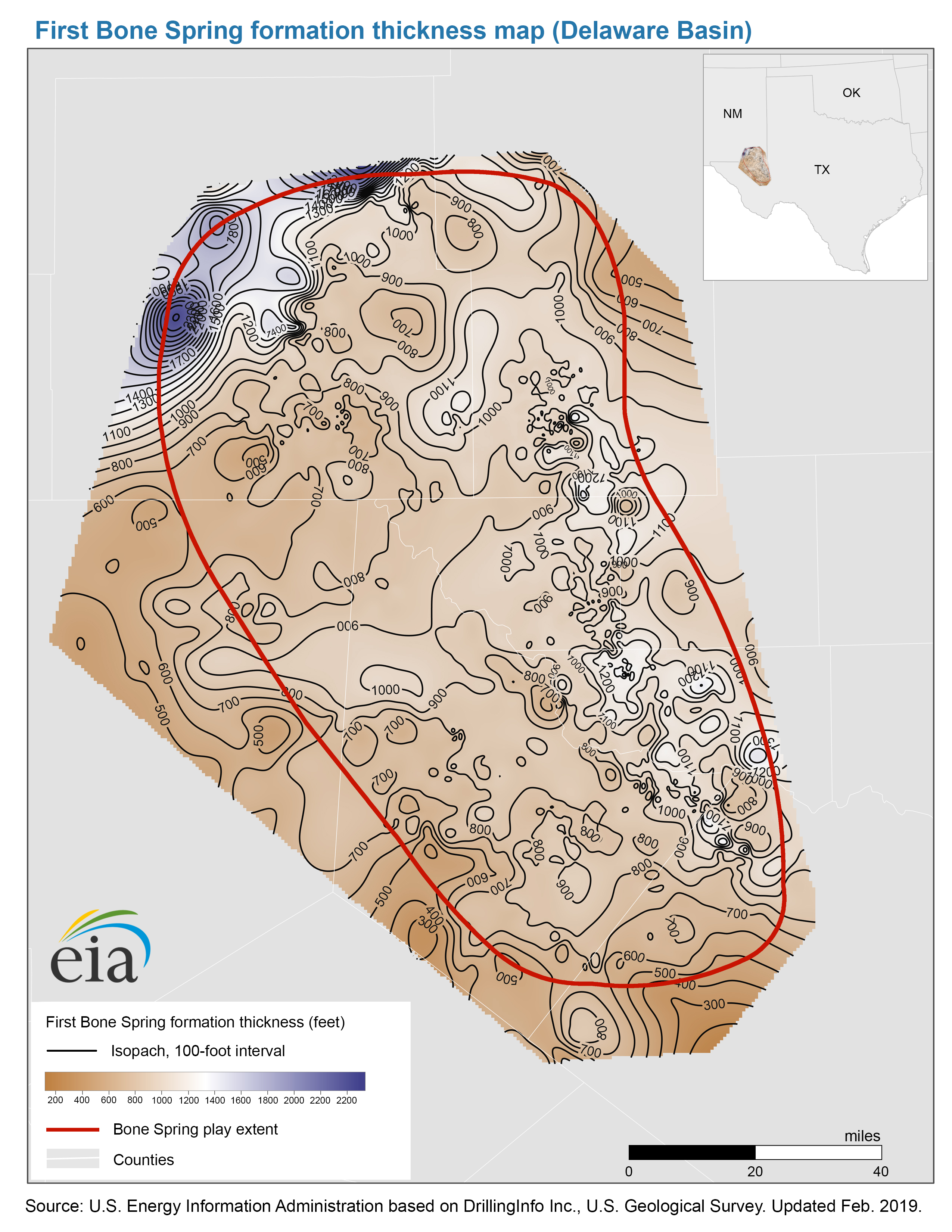
- Thickness map of the First Bone Spring formation, Delaware Basin
-
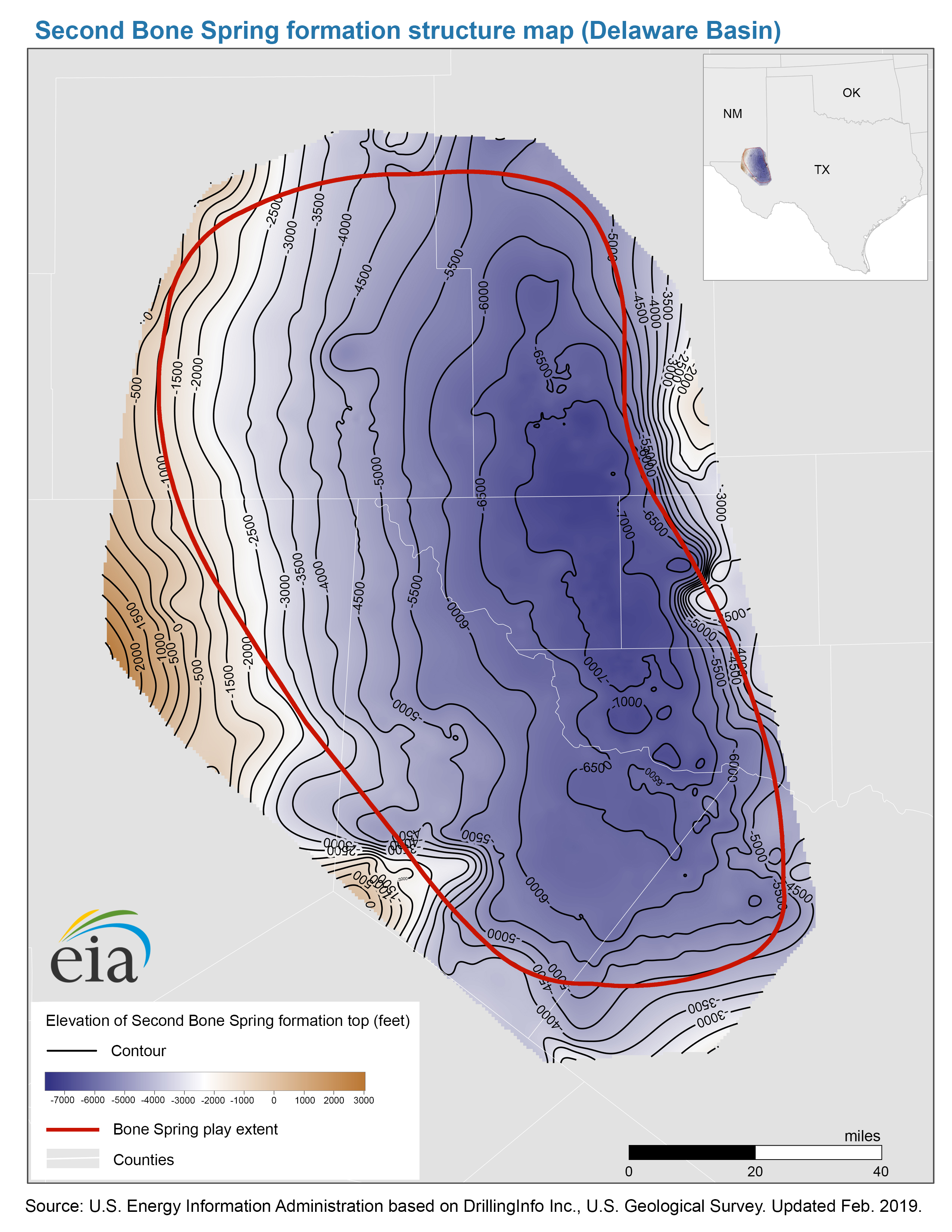
- Structure map of the Second Bone Spring formation, Delaware Basin
-
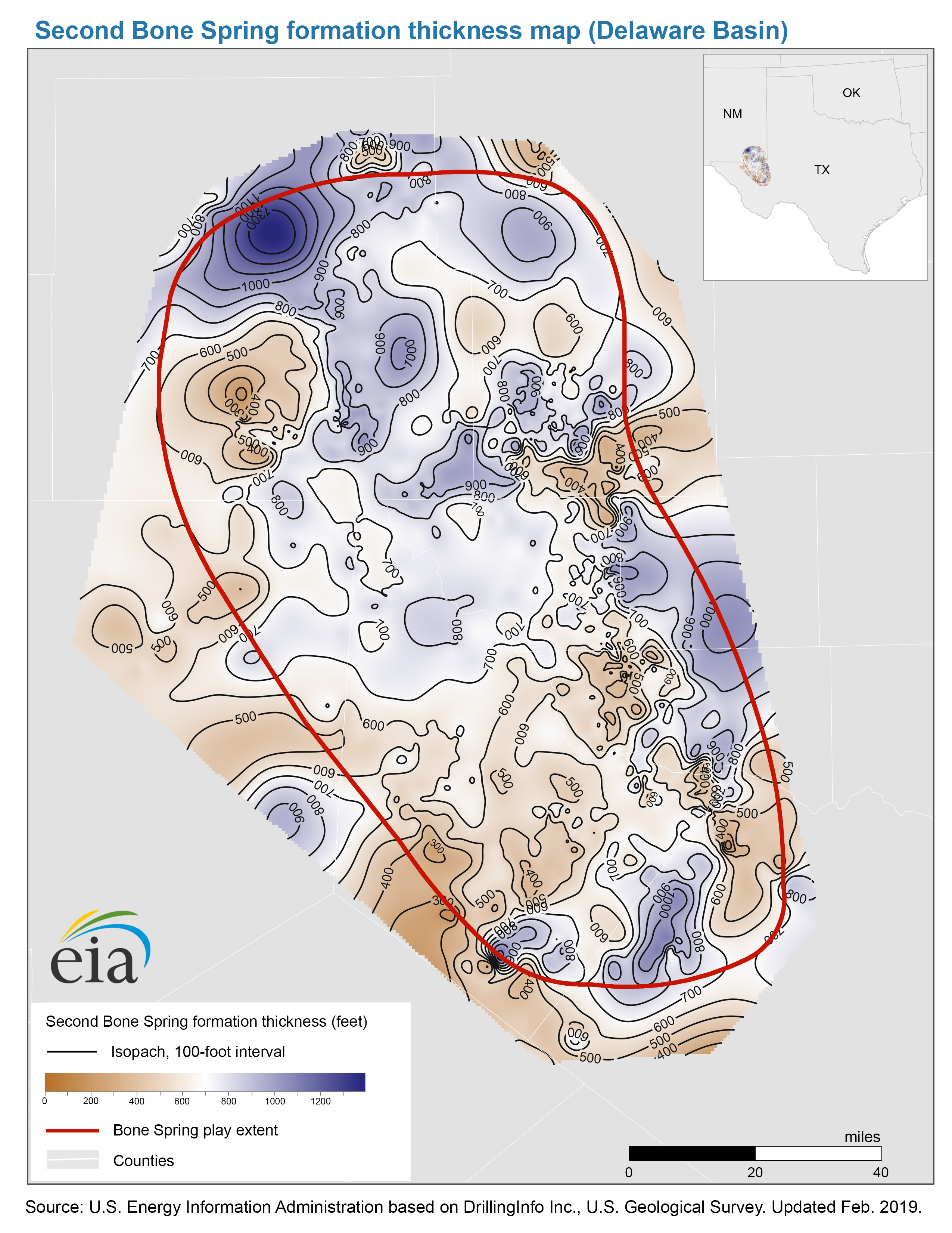
- Thickness map of the Second Bone Spring formation, Delaware Basin
-
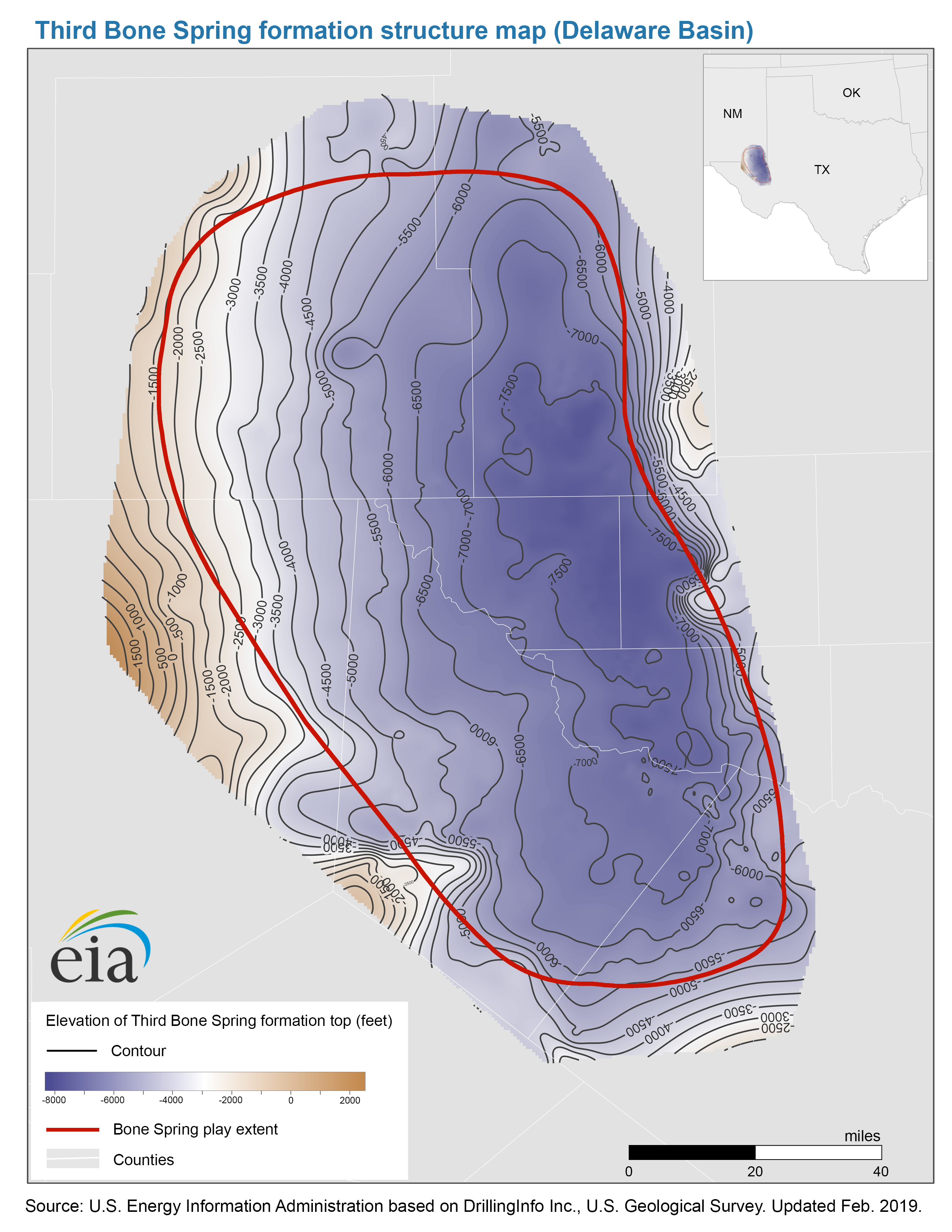
- Structure map of the Third Bone Spring formation, Delaware Basin
-
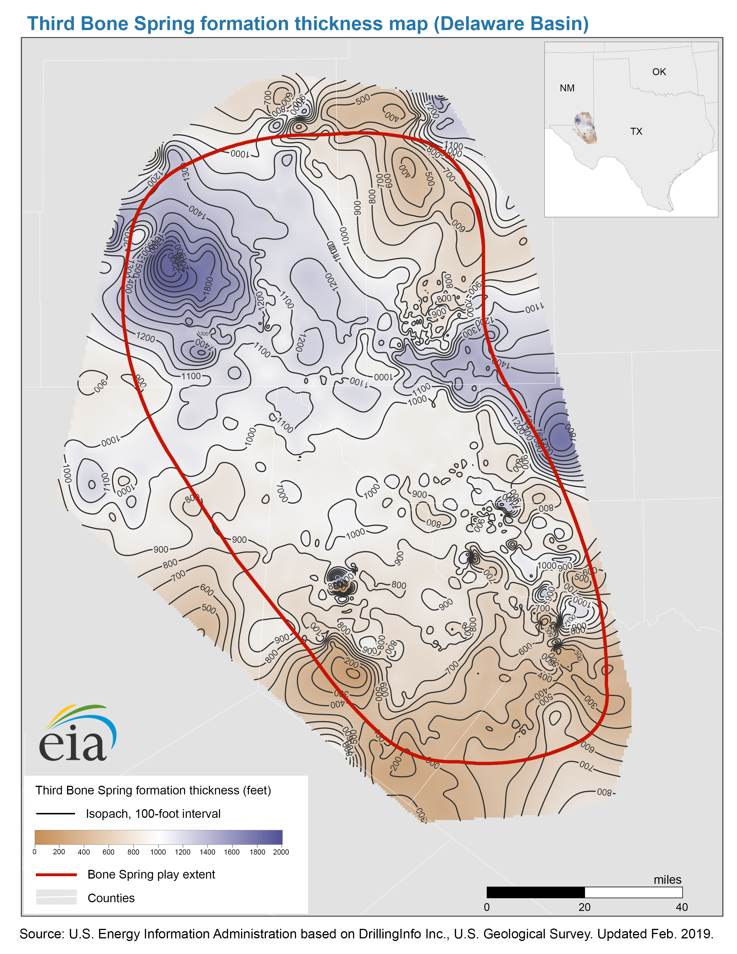
- Thickness map of the Third Bone Spring formation, Delaware Basin
- Map data
-
- Bone Spring formation benches structure and isopachs
-
- Bone Spring and Avalon Bone Spring play extents
- Wolfcamp Play
-
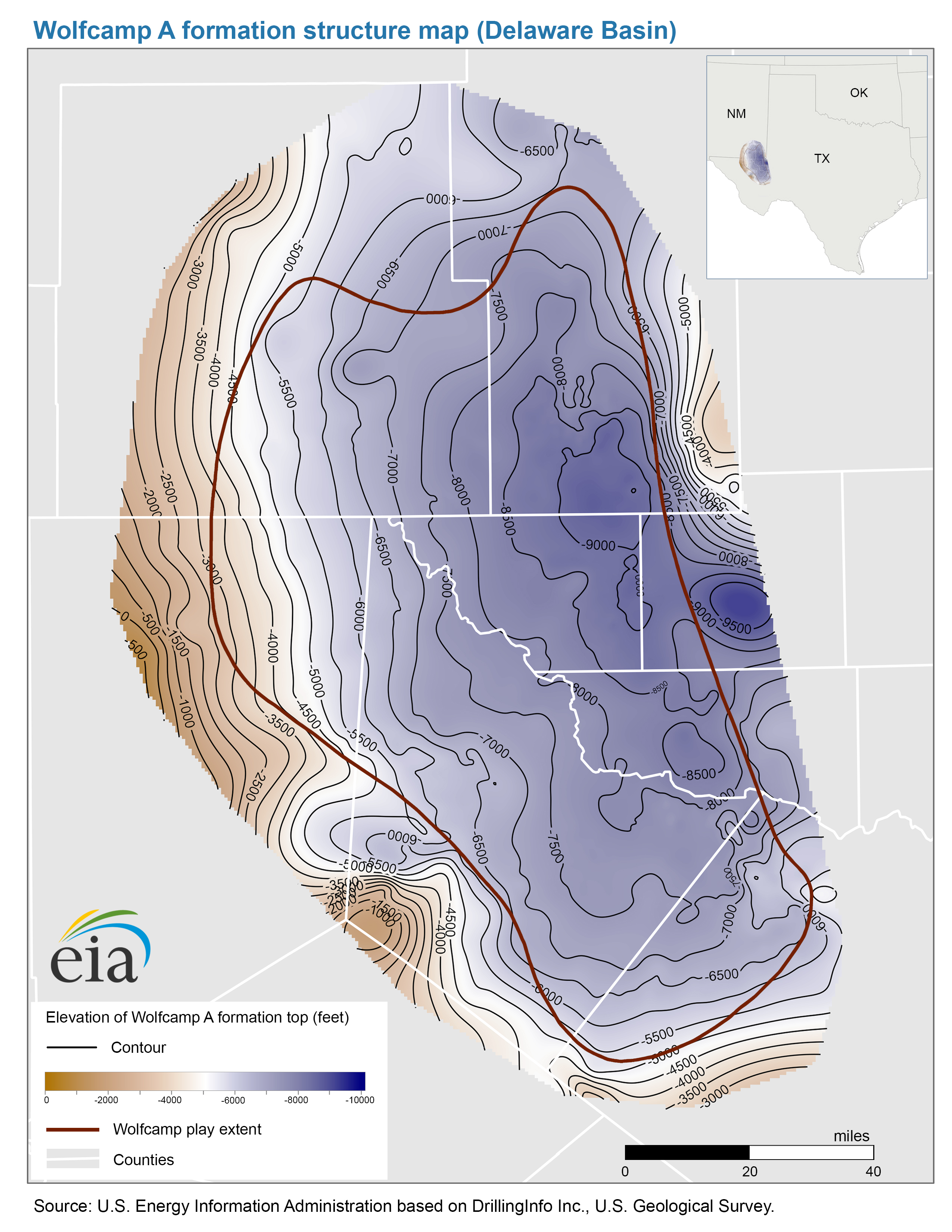
- Structure map of the Wolfcamp A formation, Delaware Basin
-
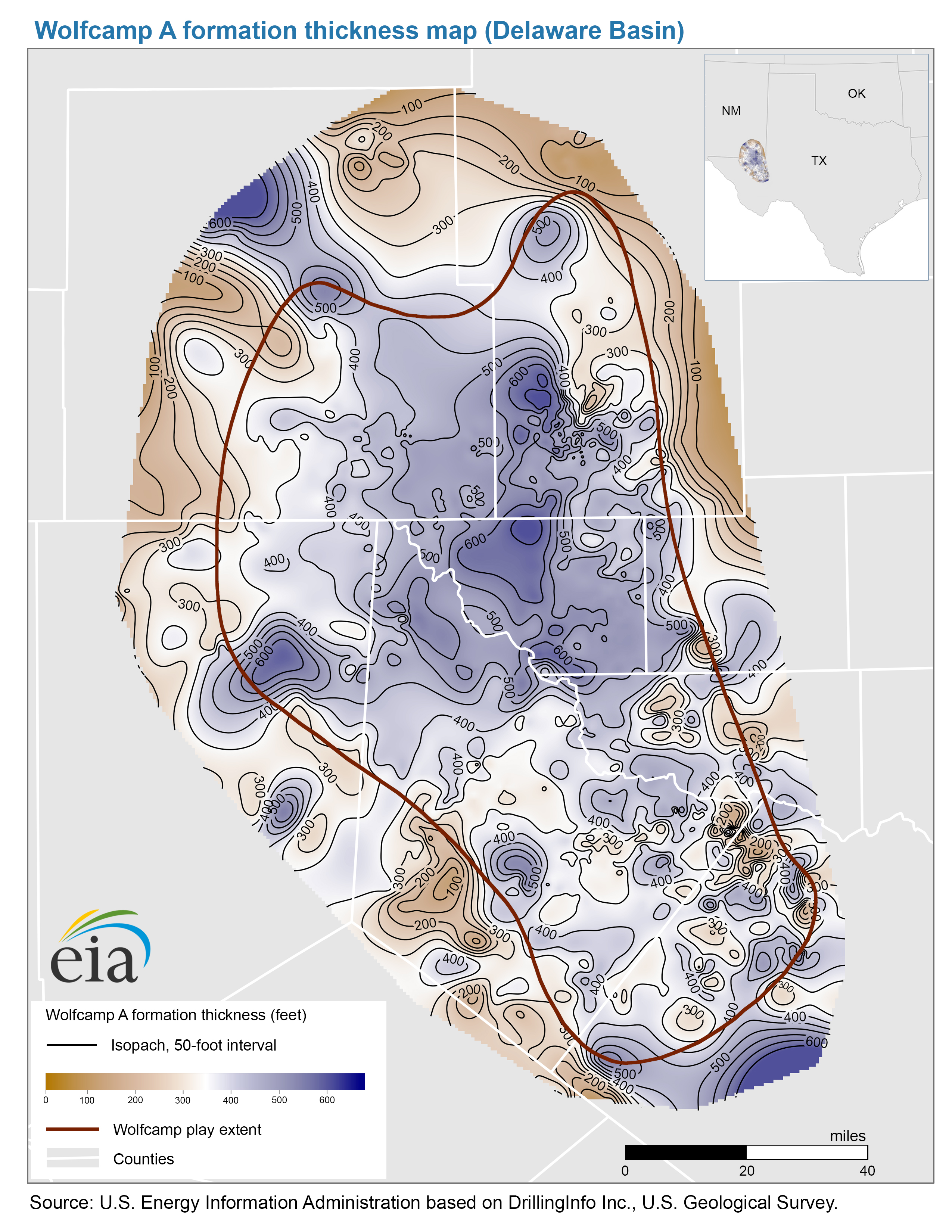
- Thickness map of the Wolfcamp A formation, Delaware Basin
-
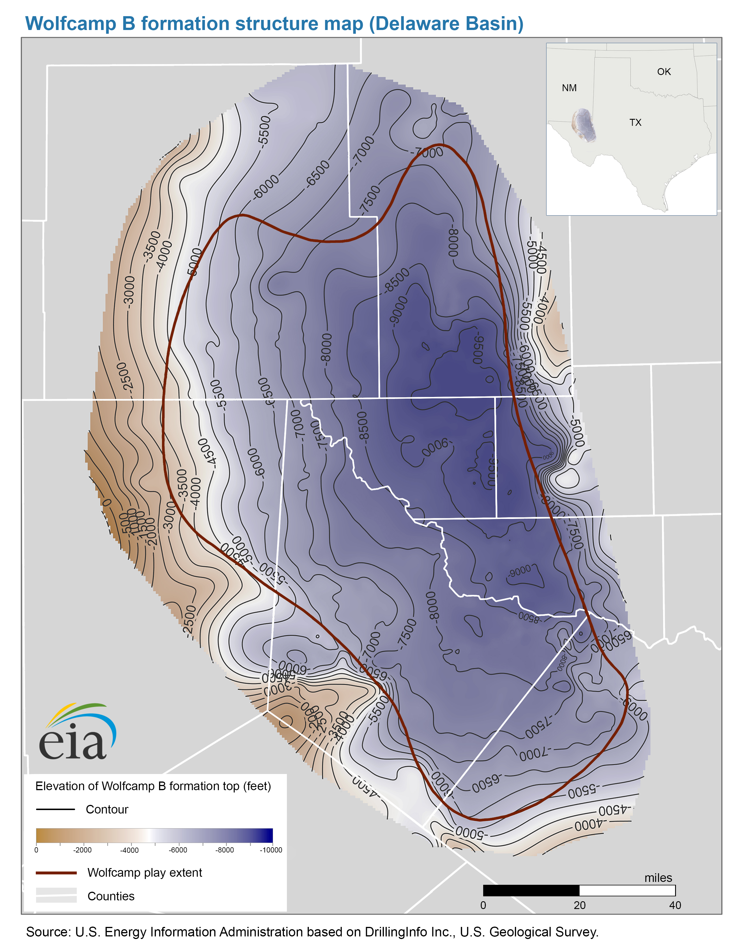
- Structure map of the Wolfcamp B formation, Delaware Basin
-
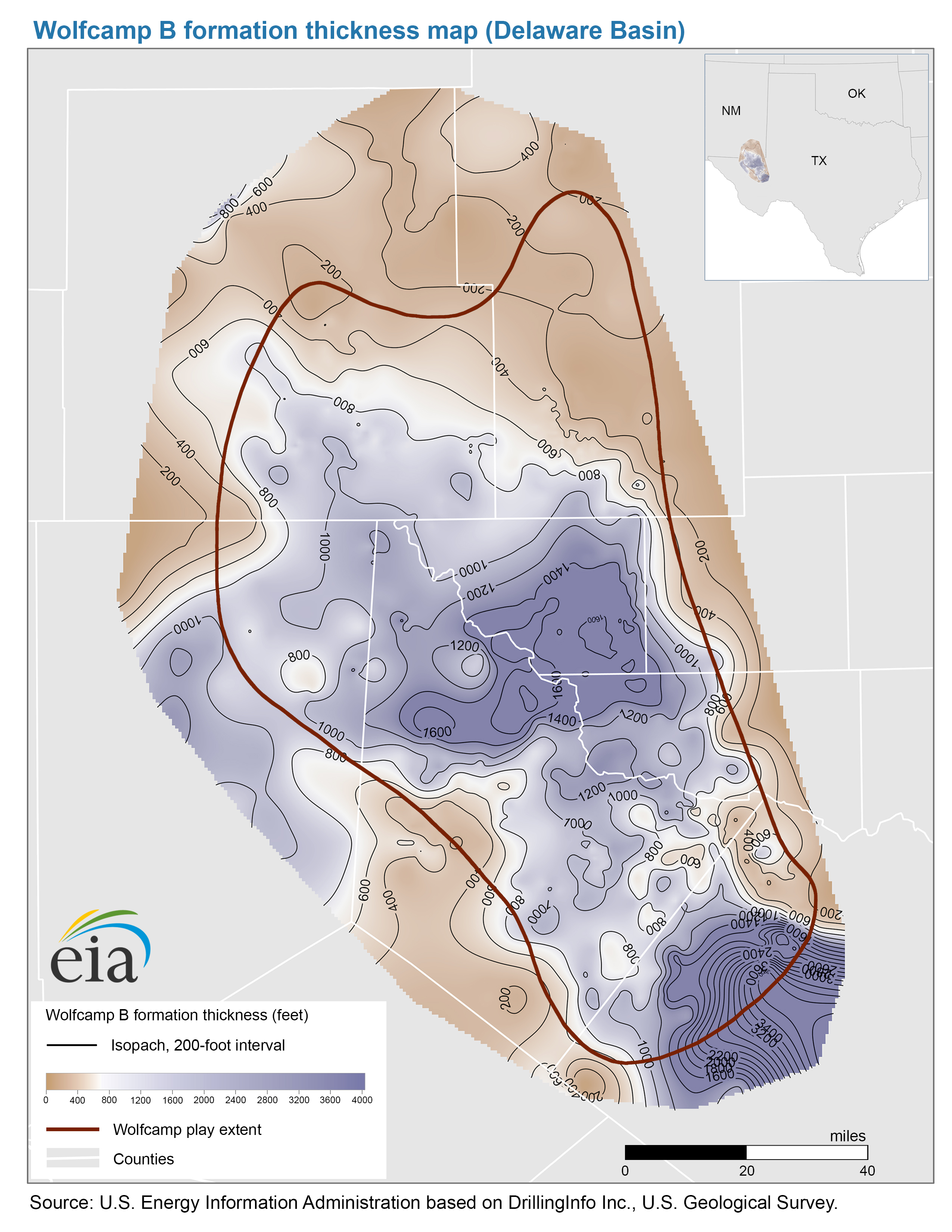
- Thickness map of the Wolfcamp B formation, Delaware Basin
- Map data
-
- Wolfcamp A formation structure and isopachs, Delaware Basin
-
- Wolfcamp B formation structure and isopachs, Delaware Basin
Midland Subbasin, TX
- Spraberry Play
-
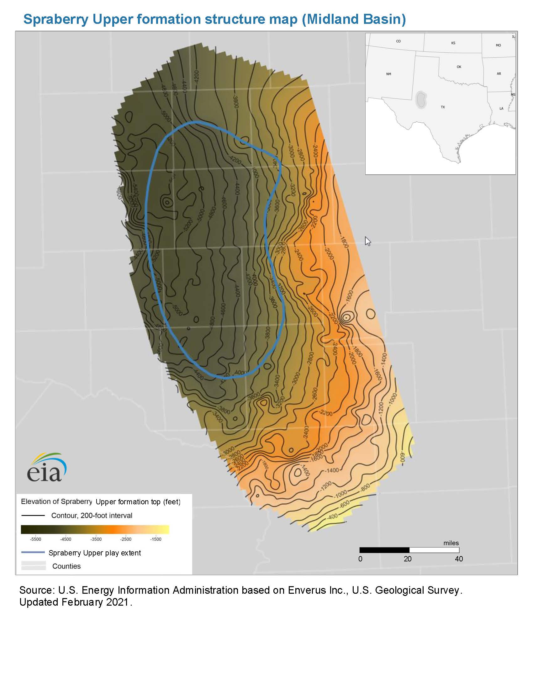
- Structure map of the Spraberry Upper formation, Midland Basin
-
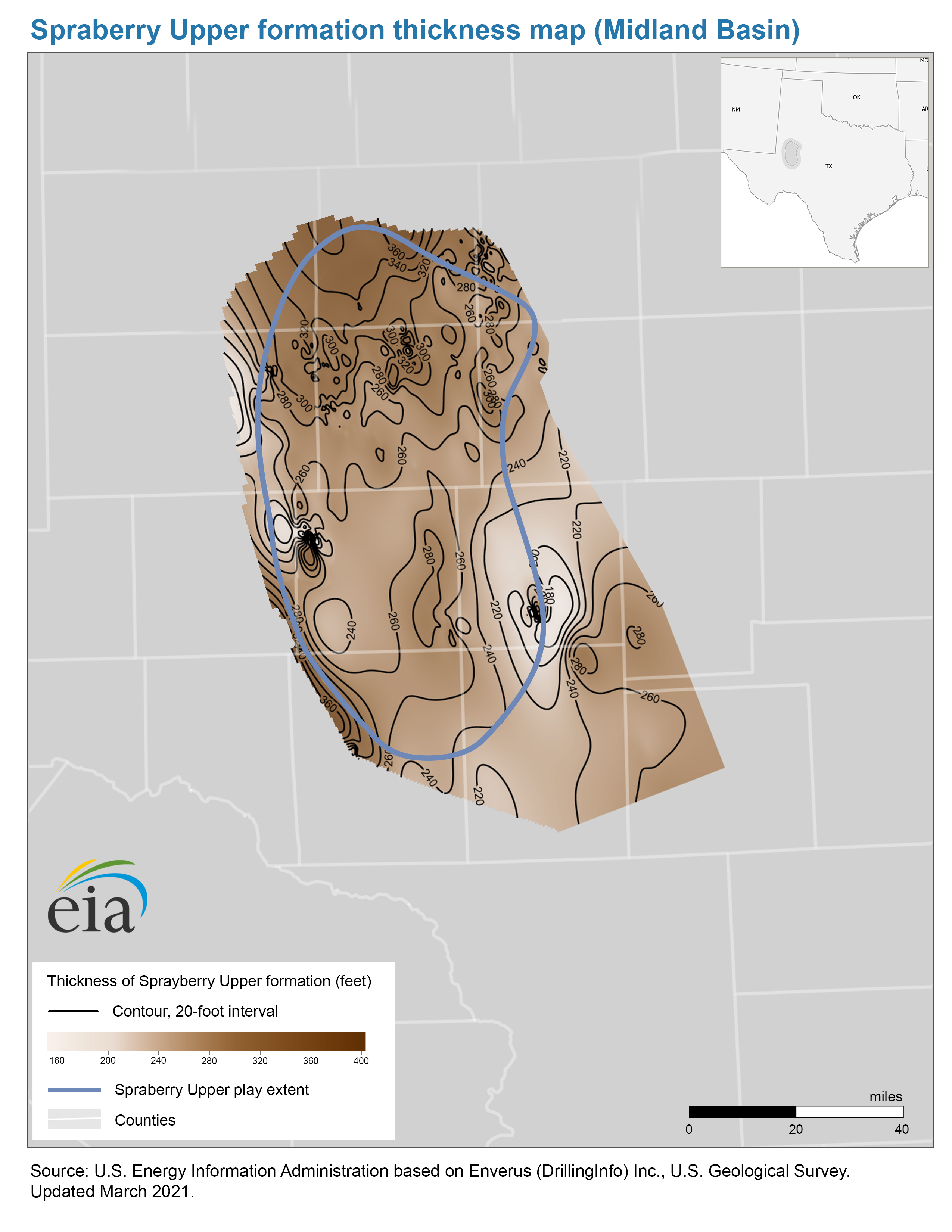
- Thickness map of the Spraberry Upper formation, Midland Basin
-
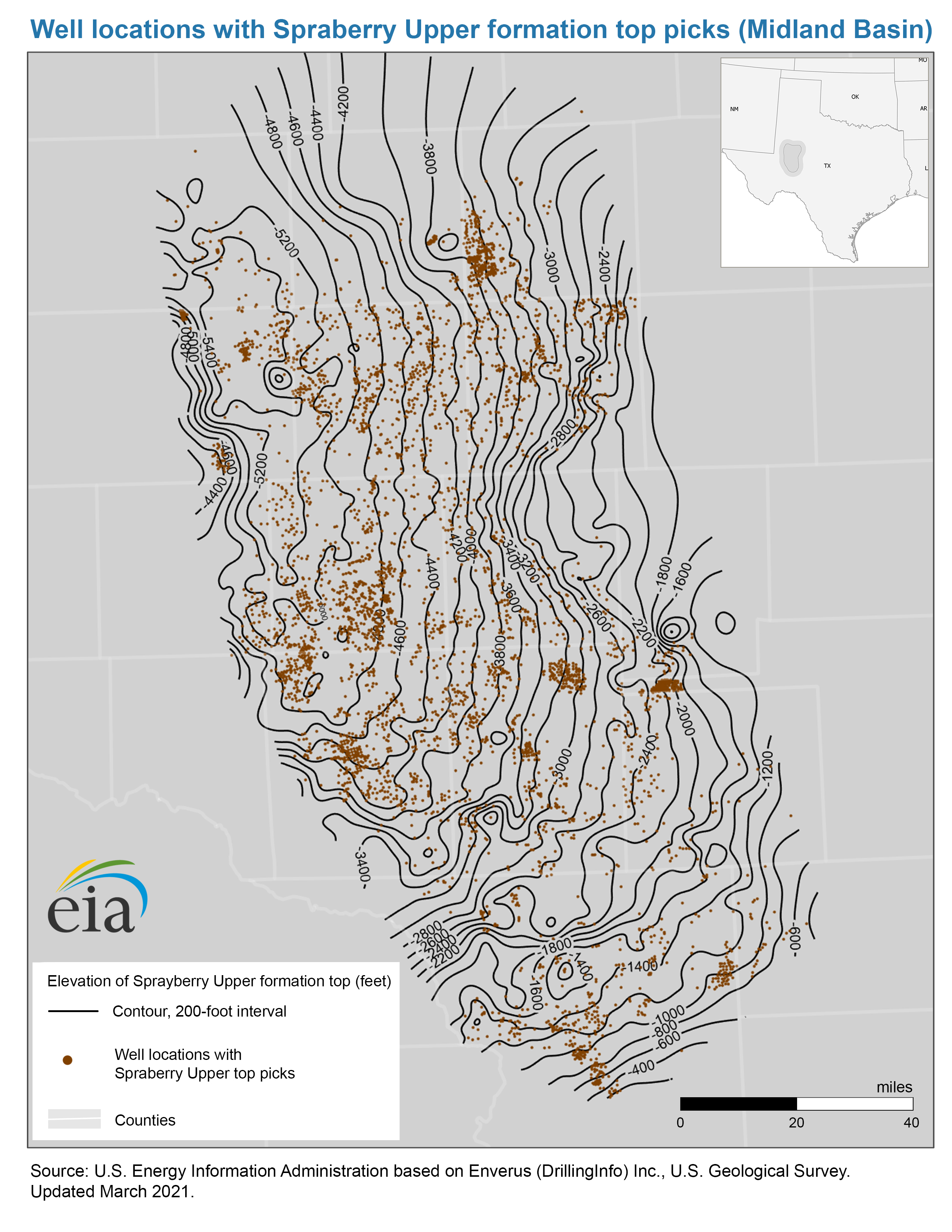
- Well locations with Spraberry Upper top picks map, Midland Basin
-
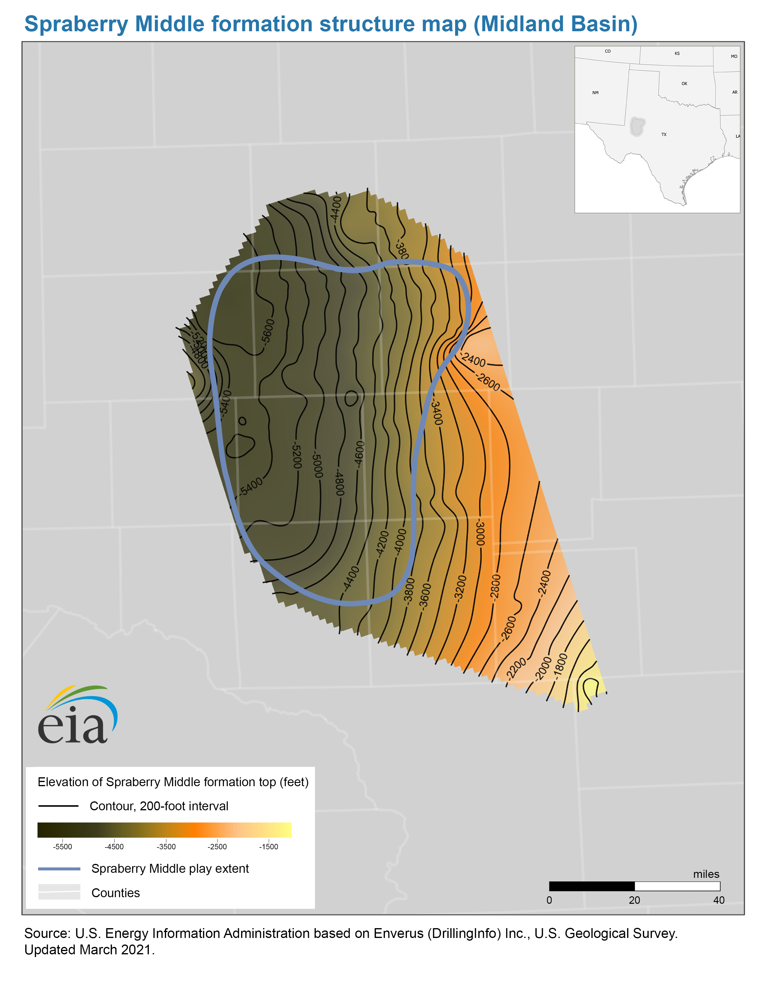
- Structure map of the Spraberry Middle formation, Midland Basin
-
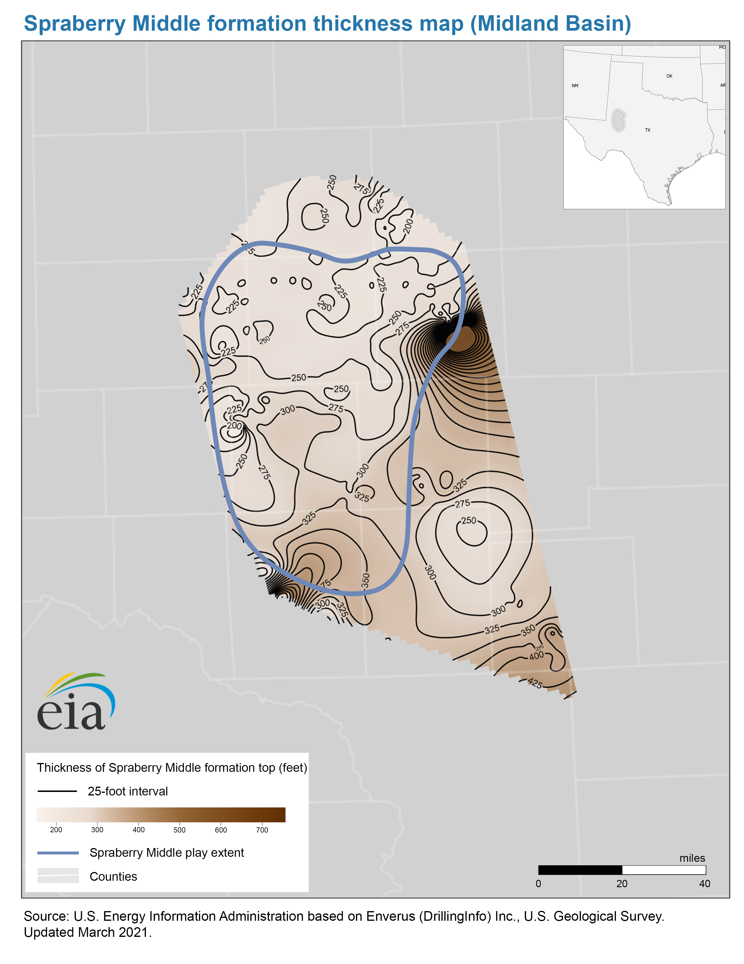
- Thickness map of the Spraberry Middle formation, Midland Basin
-
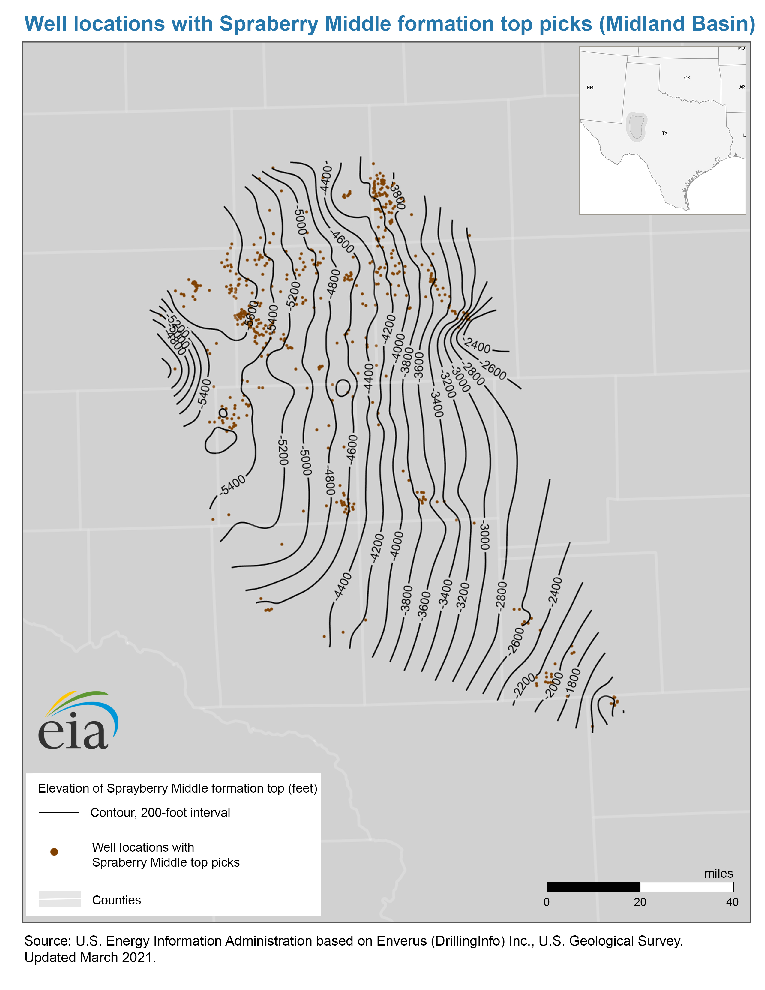
- Well locations with Spraberry Middle top picks map, Midland Basin
-
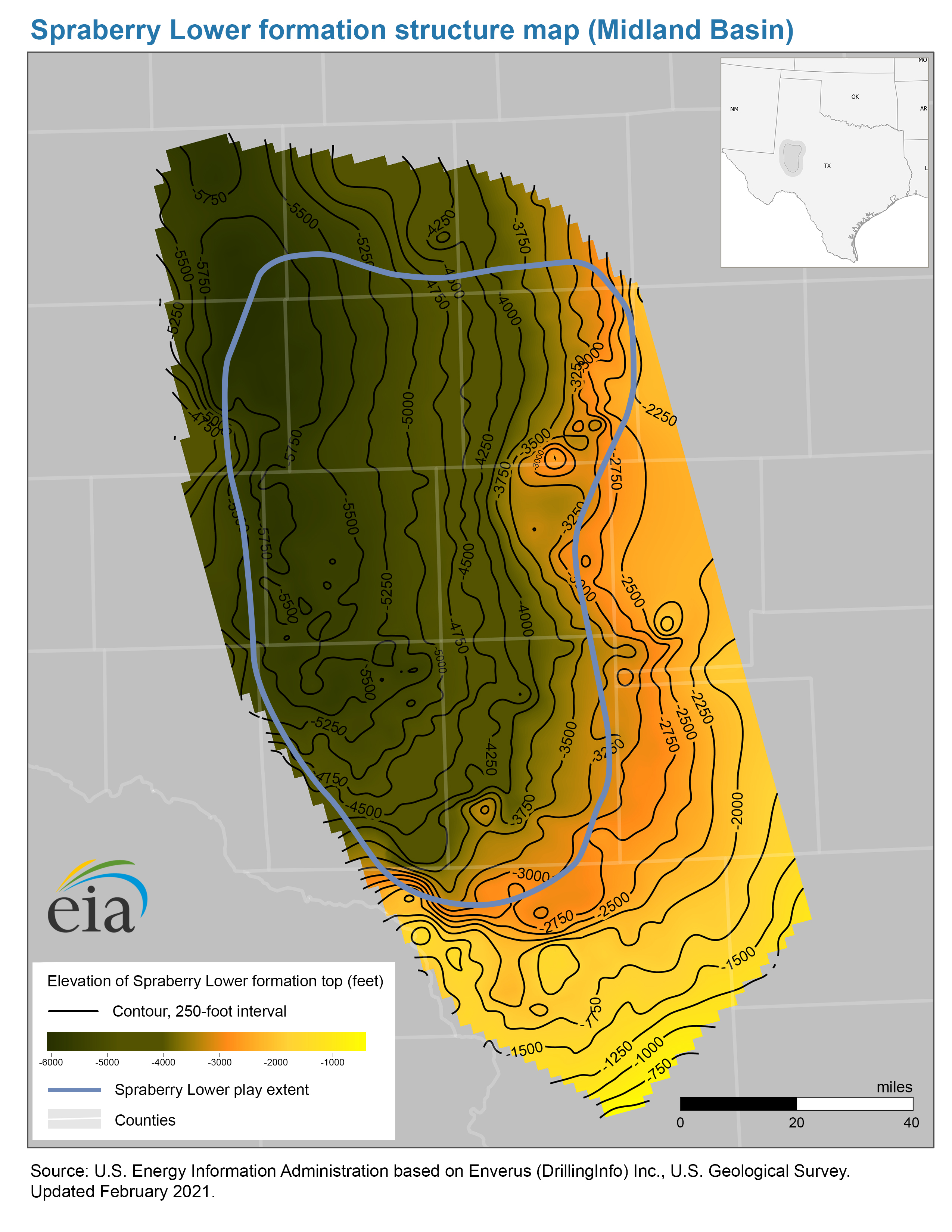
- Structure map of the Spraberry Lower formation, Midland Basin
-
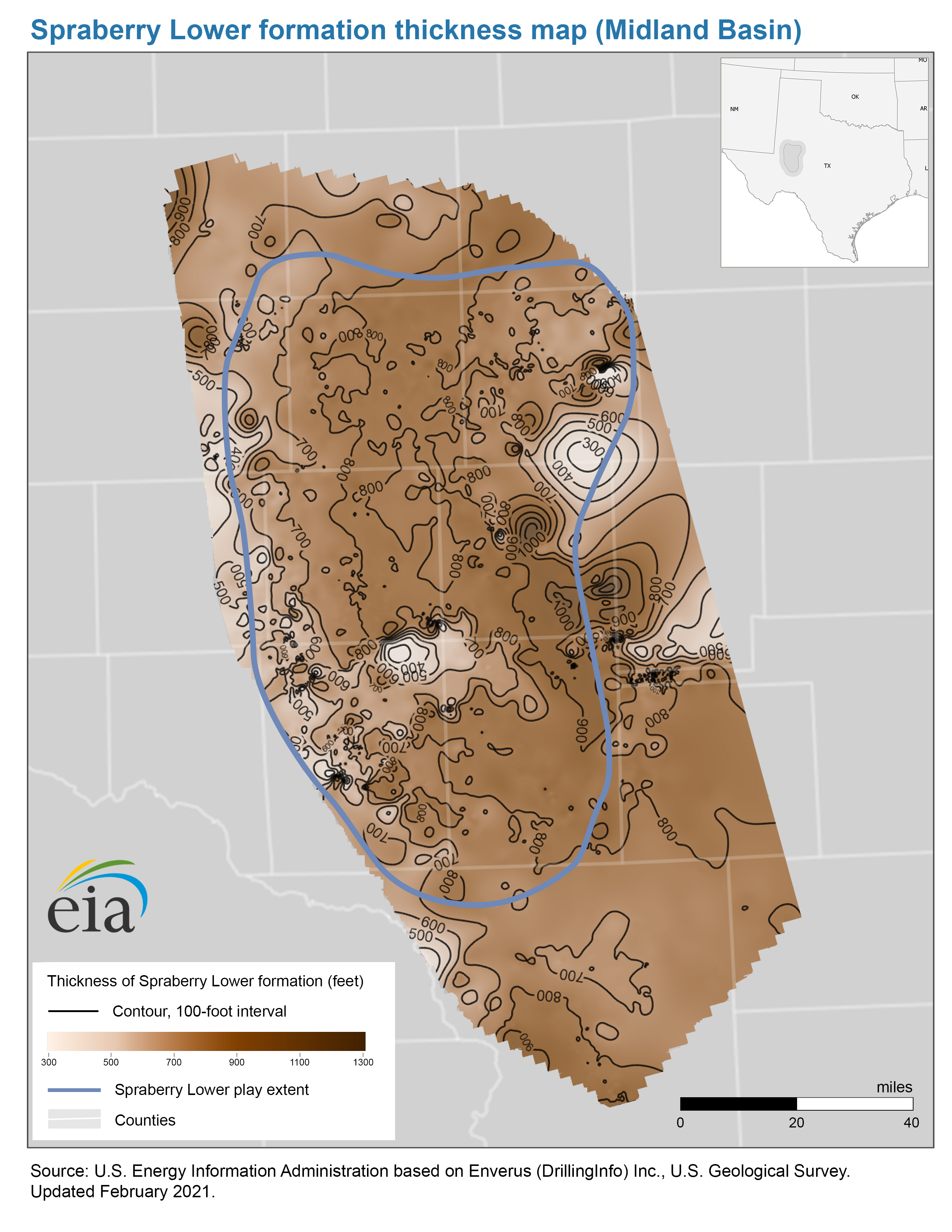
- Thickness map of the Spraberry Lower formation, Midland Basin
-
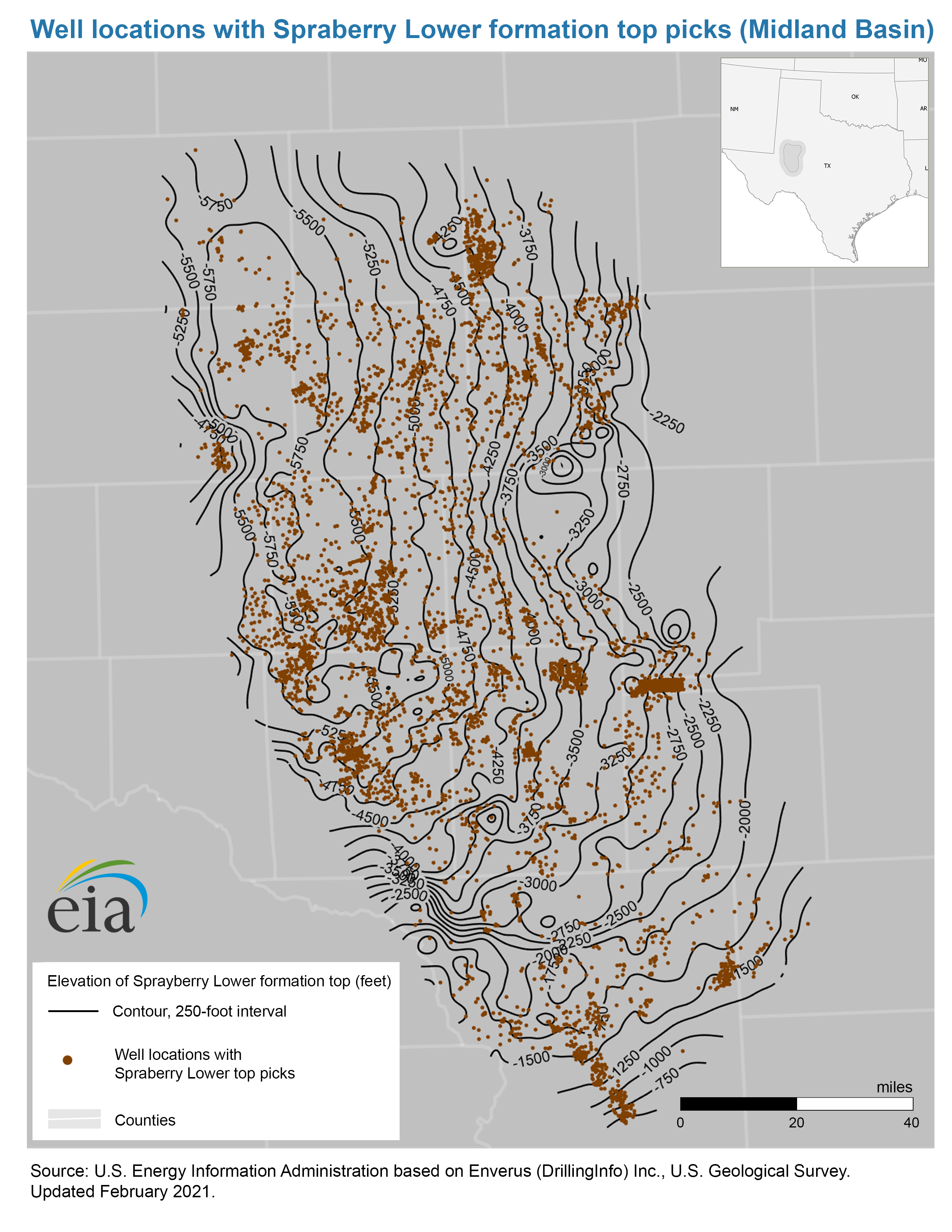
- Well locations with Spraberry Lower top picks map, Midland Basin
- Map data
-
- Spraberry Upper play boundaries, formation structure and isopachs
-
- Spraberry Middle play boundaries, formation structure and isopachs
-
- Spraberry Lower formation structure and isopachs, Midland Basin
-
- Spraberry Lower play boundaries, Midland Basin
- Wolfcamp Play
-
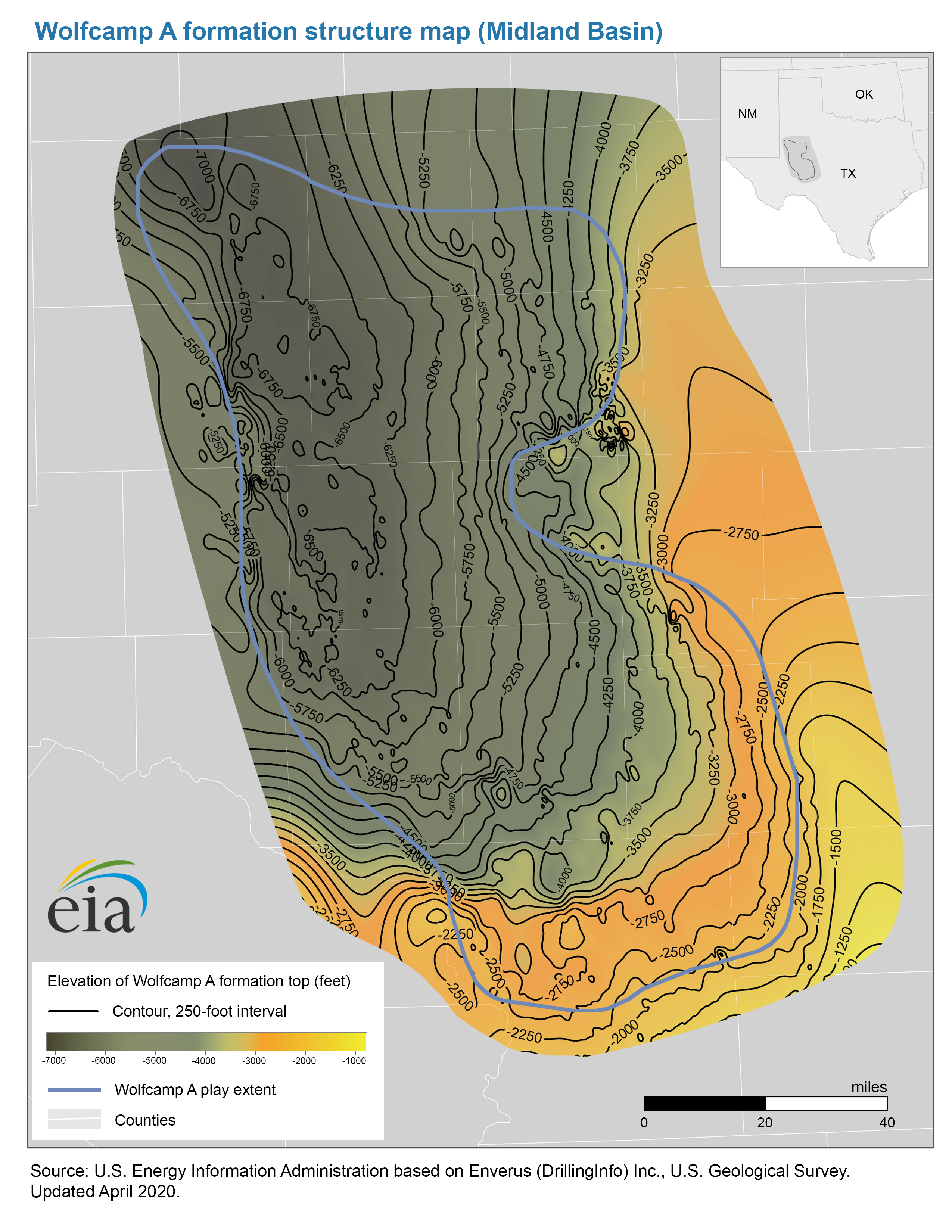
- Structure map of the Wolfcamp A formation, Midland Basin
-
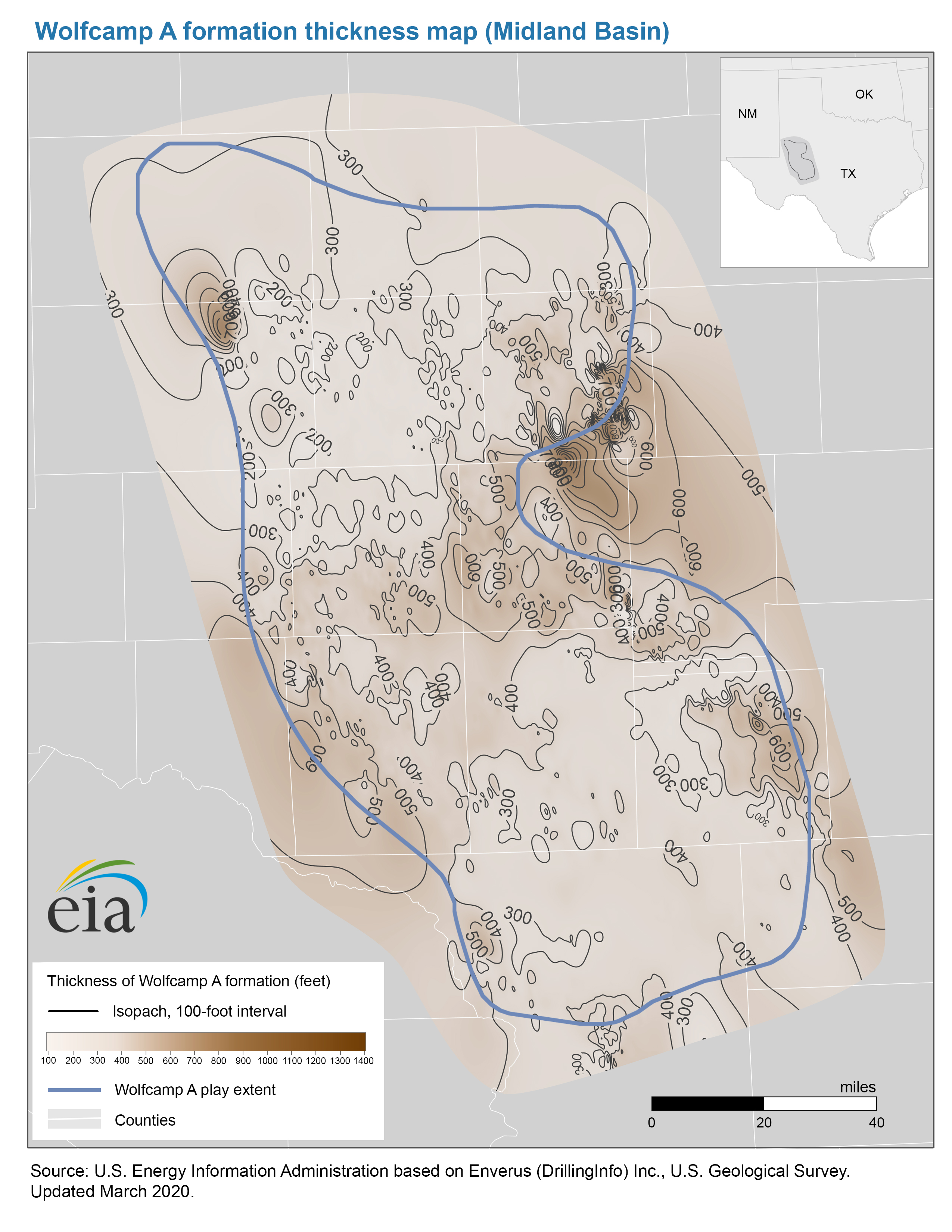
- Thickness map of the Wolfcamp A formation, Midland Basin
-
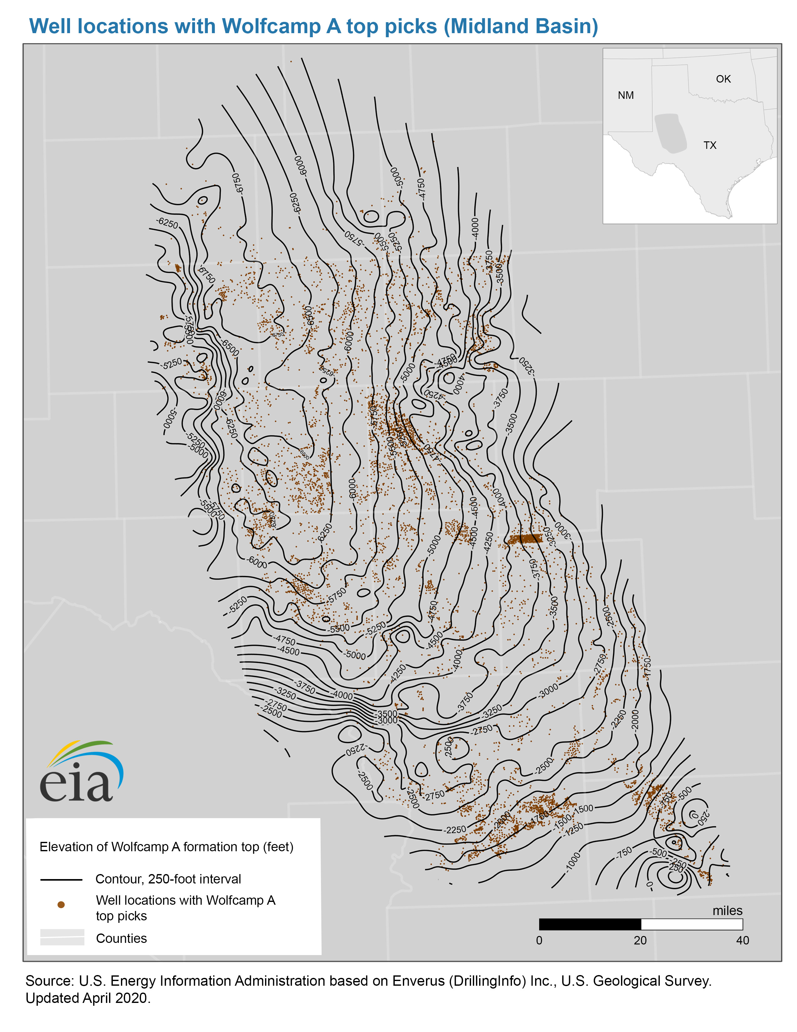
- Well locations with Wolfcamp A top picks map, Midland Basin
-
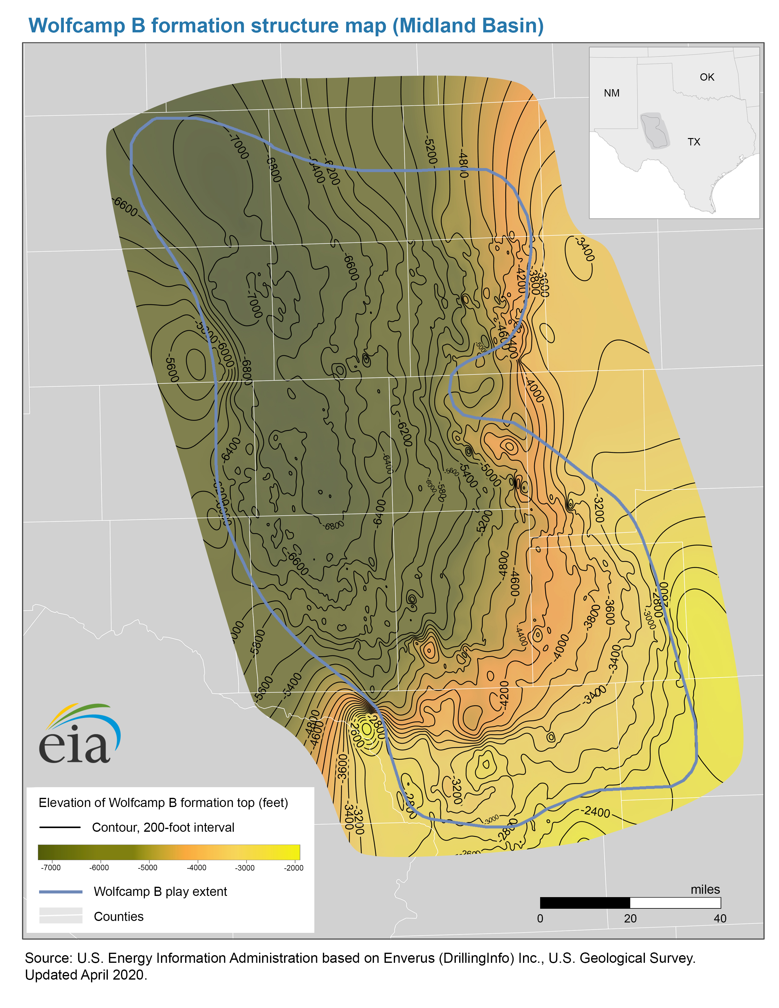
- Structure map of the Wolfcamp B formation, Midland Basin
-
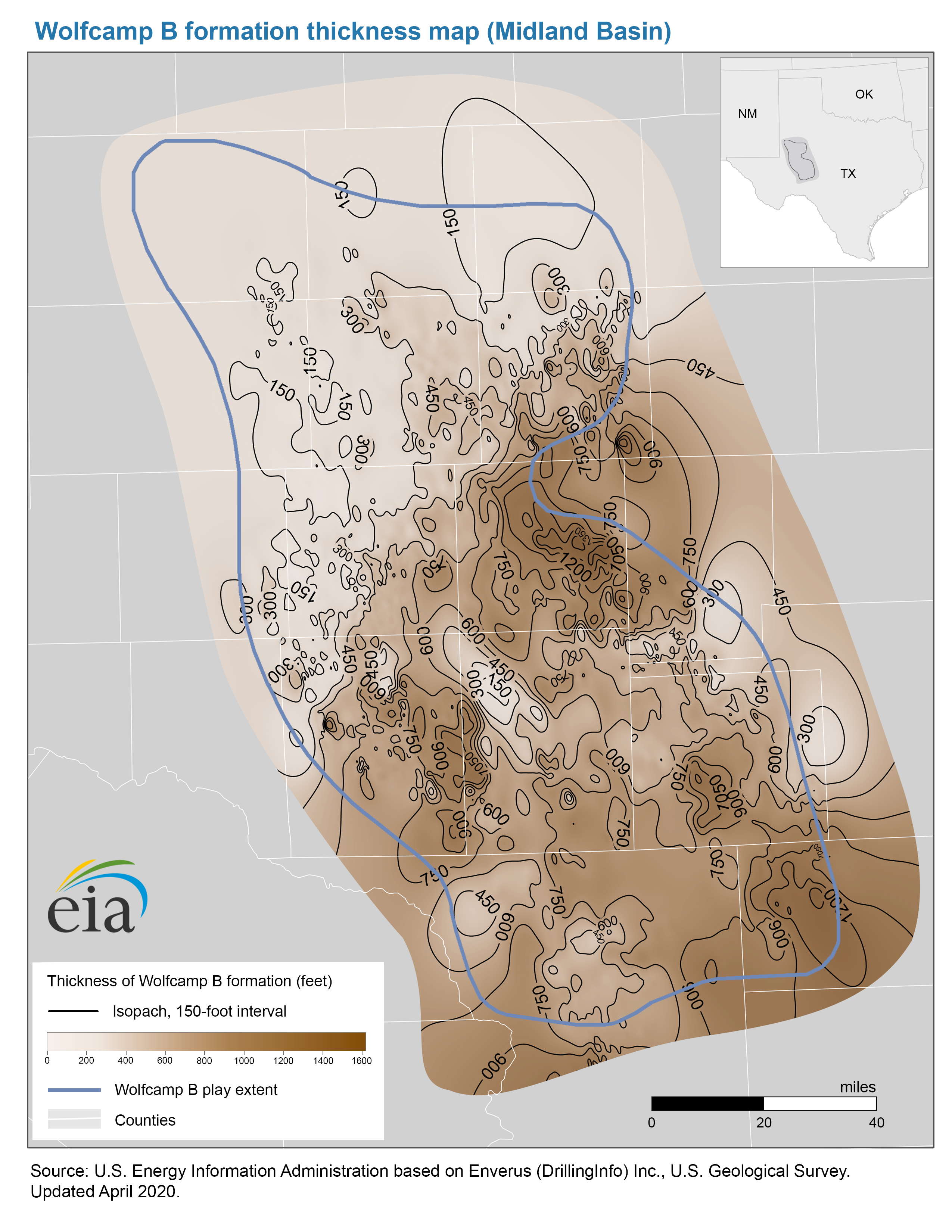
- Thickness map of the Wolfcamp B formation, Midland Basin
-
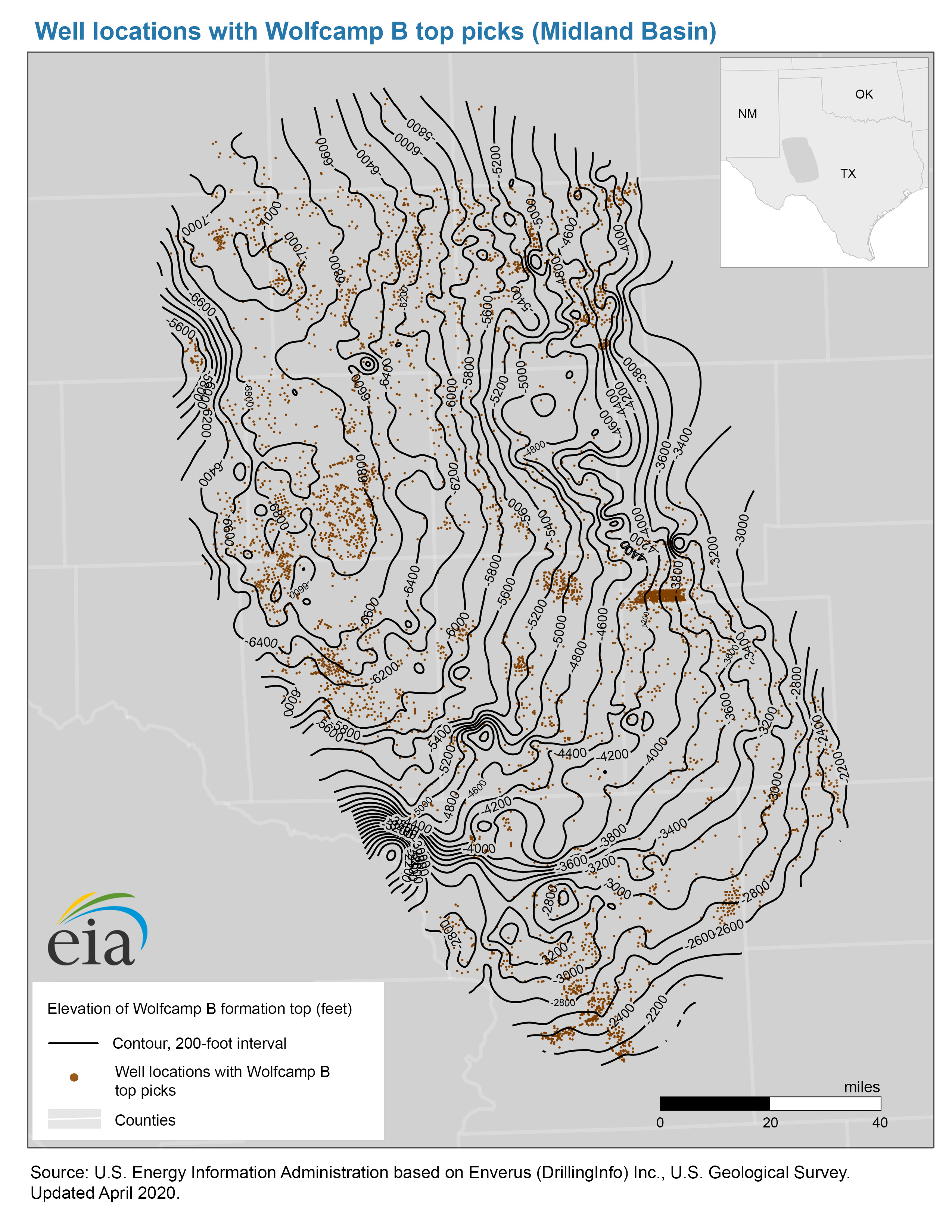
- Well locations with Wolfcamp B top picks map, Midland Basin
-
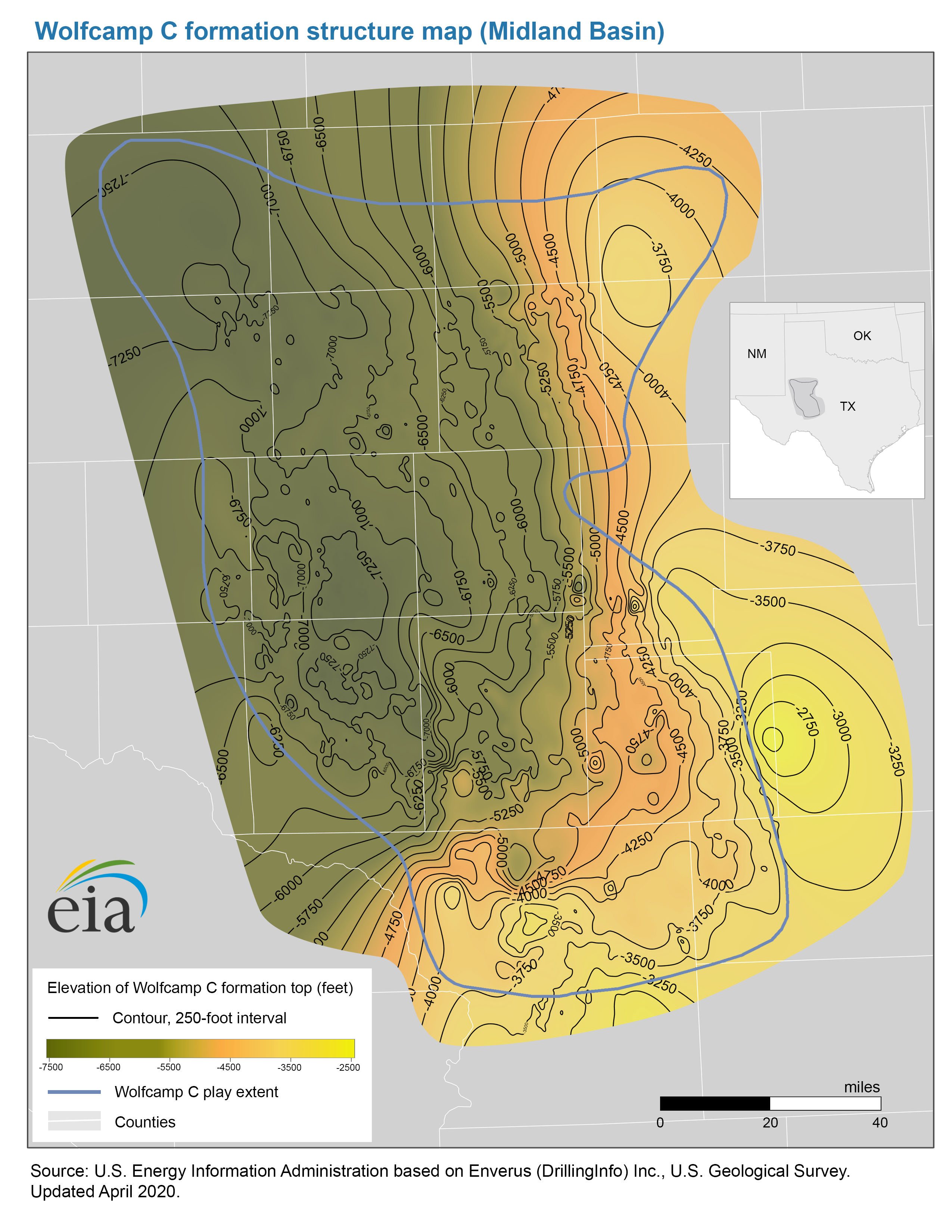
- Structure map of the Wolfcamp C formation, Midland Basin
-
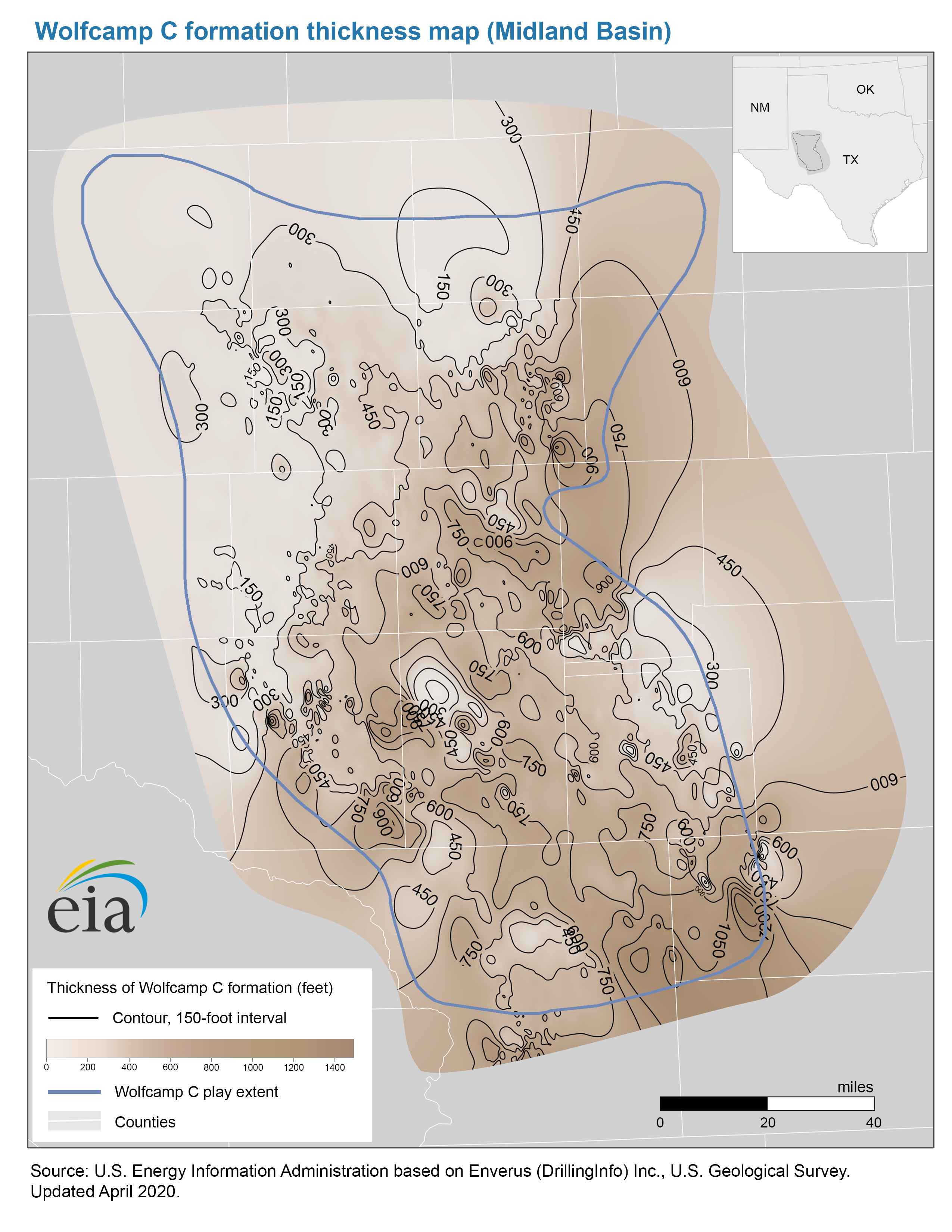
- Thickness map of the Wolfcamp C formation, Midland Basin
-
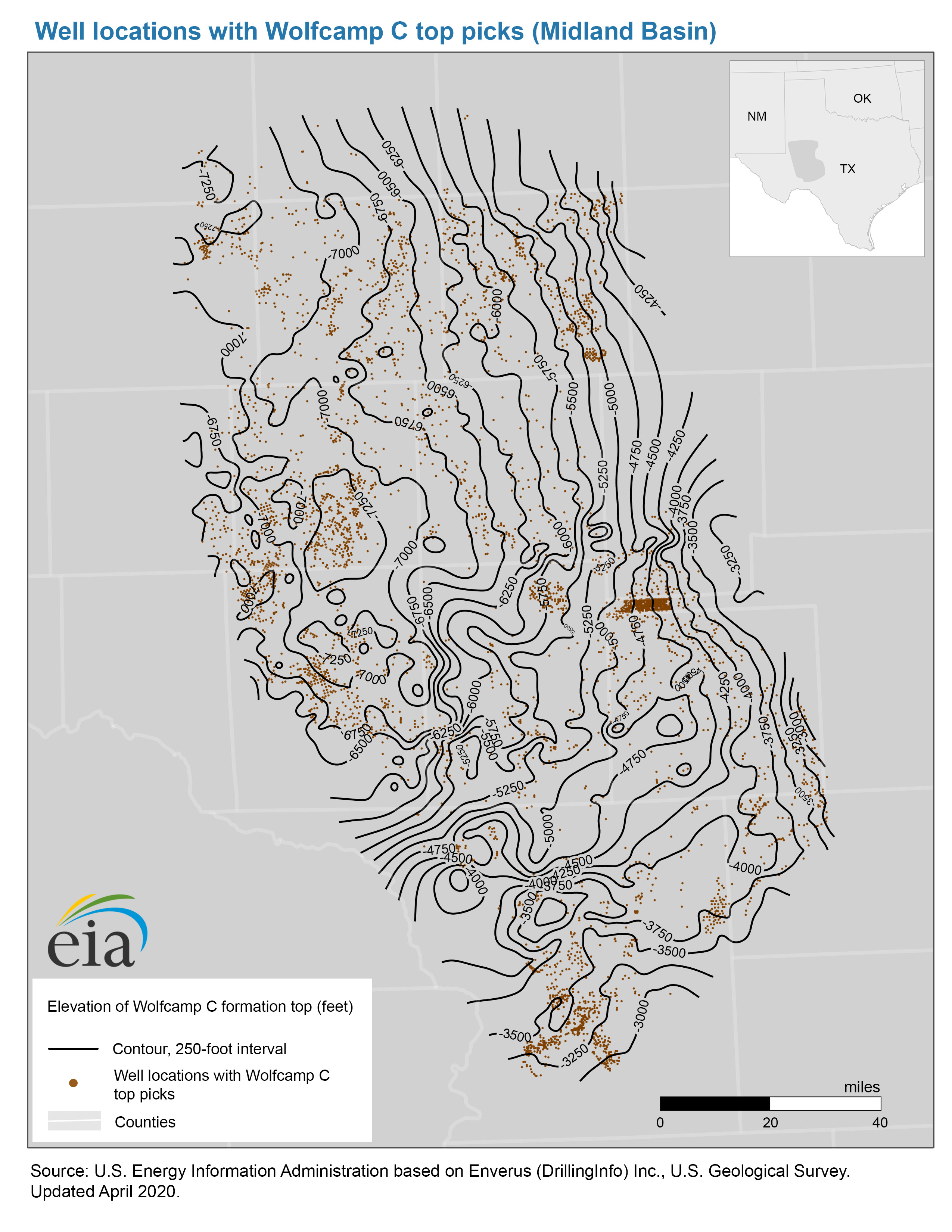
- Well locations with Wolfcamp C top picks map, Midland Basin
-
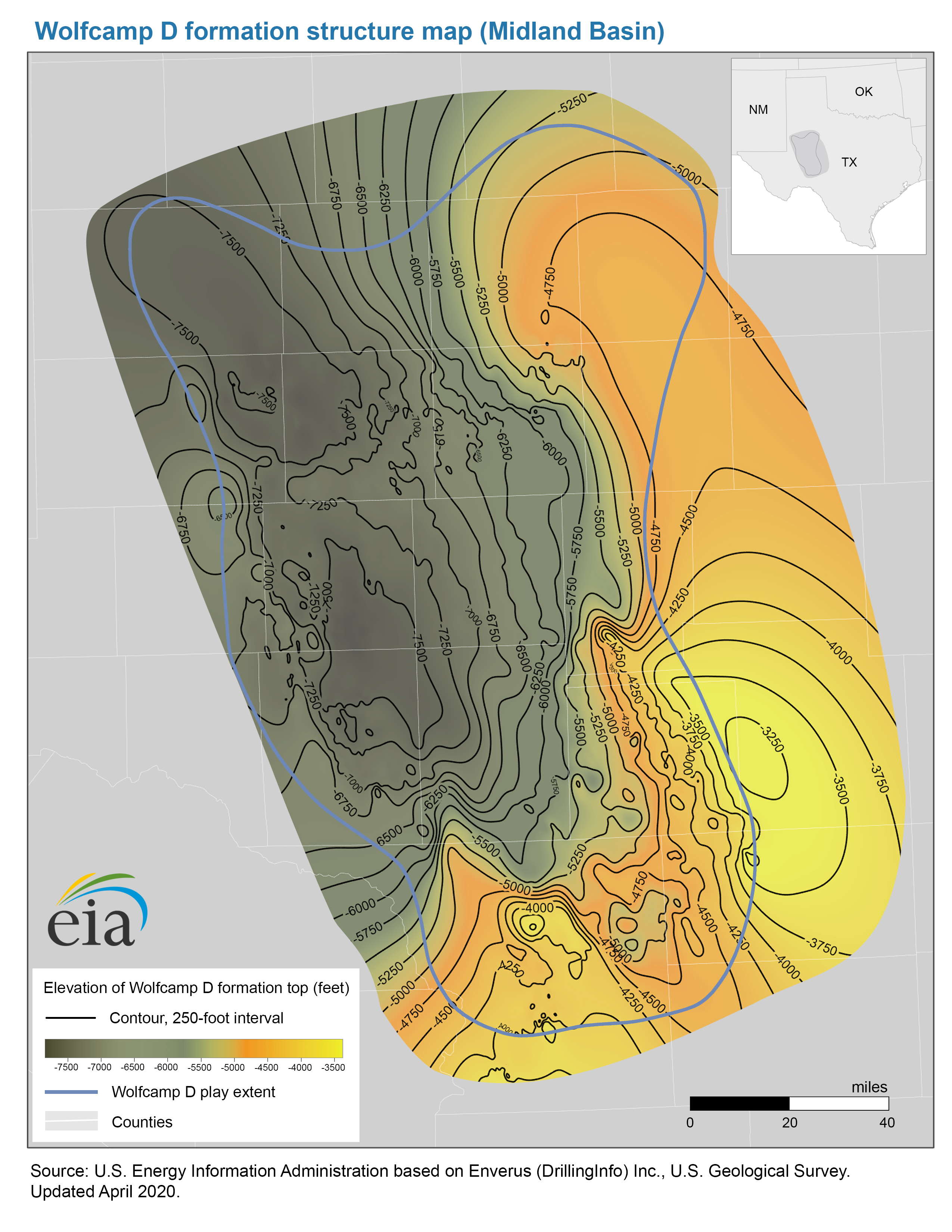
- Structure map of the Wolfcamp D formation, Midland Basin
-
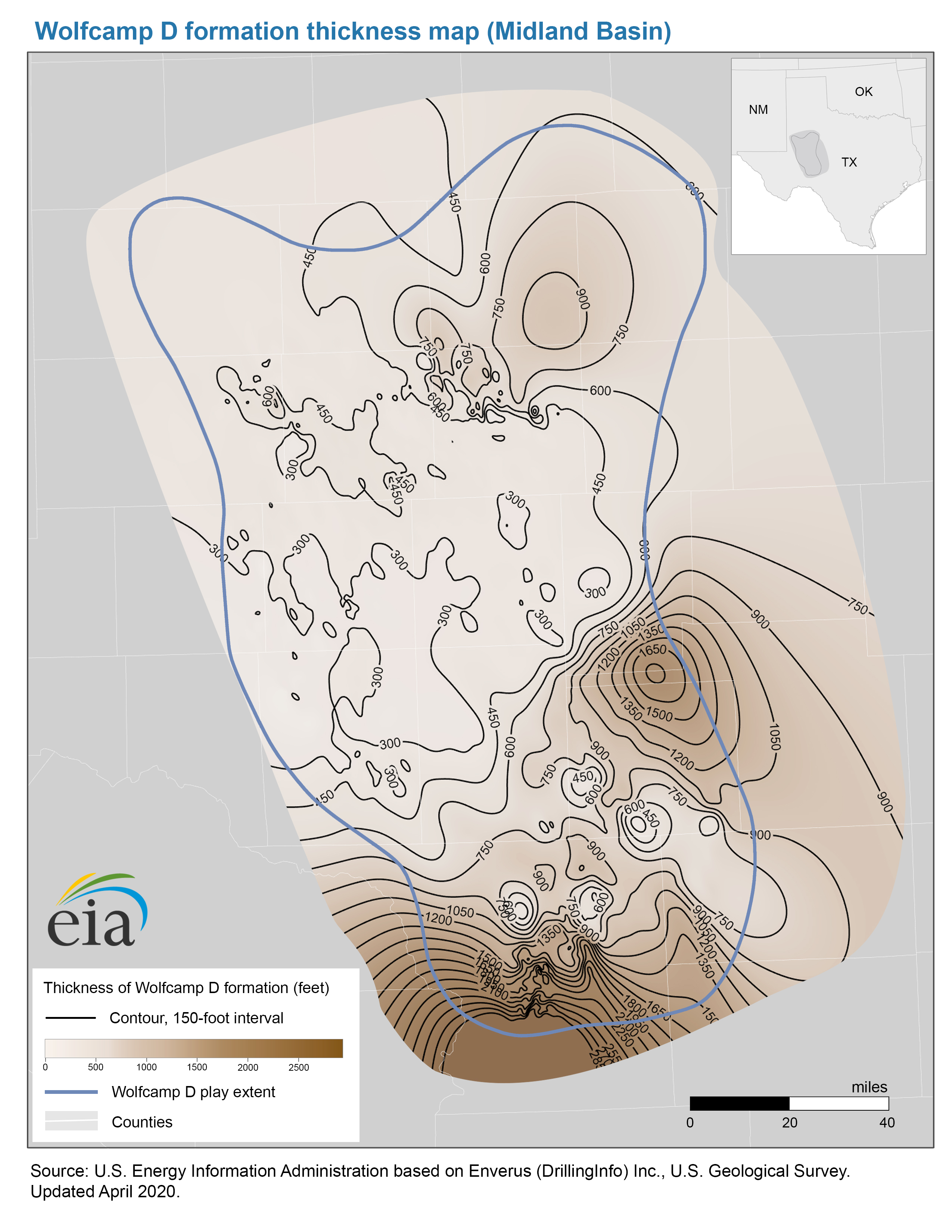
- Thickness map of the Wolfcamp D formation, Midland BasinThickness map of the Wolfcamp D formation, Midland Basin
-
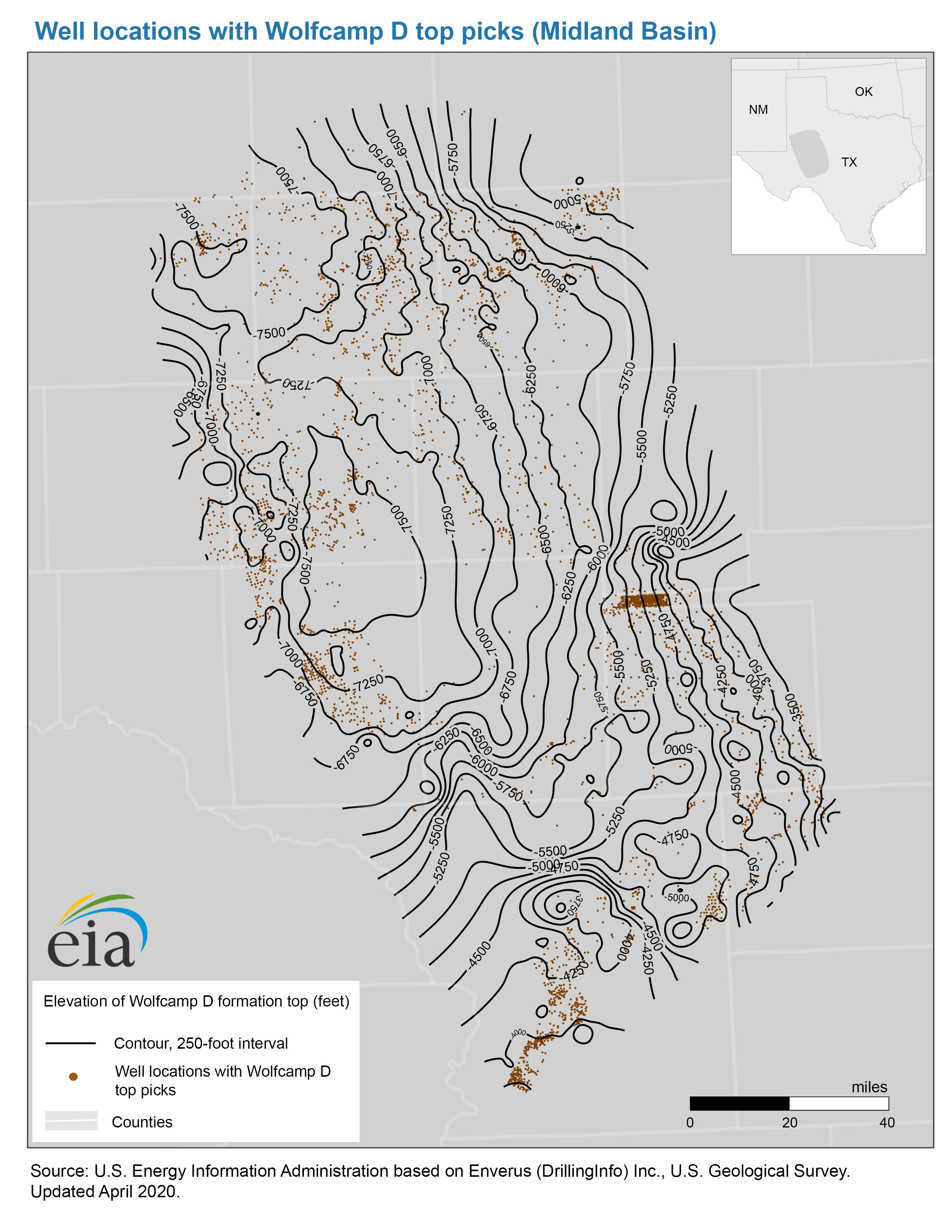
- Well locations with Wolfcamp D top picks map, Midland Basin
- Map data
-
- Wolfcamp A, B, C, and D formation structure and isopachs, Midland Basin
-
- Wolfcamp A, B, C, and D play boundaries, Midland Basin
Rocky Mountain Sedimentary System (Basins: Denver, Greater Green River, Park, Powder River), MT, WY, UT, CO, NE, and NM
- Map data
-
- Niobrara play boundaries, structure and isopachs
Texas-Louisiana Salt Basin, TX, LA, and MS
-
- Haynesville-Bossier Shale Play
Western Gulf Basin, TX
-
- Eagle Ford Play Report: geology review and map updates
-
- Eagle Ford Shale Play
-
- History animation: Eagle Ford shale production, 2006-2010
- Map data
-
- Eagle Ford play boundaries, structure and isopachs
Williston Basin, MT, ND, and SD
-
- Bakken Shale Play, North Dakota, Montana, Saskatchewan & Manitoba
-
- History animation: Bakken shale production, 1985-2010
- Map data
-
- Bakken and Three Forks play boundaries, structure and isopachs
Application of the decision procedure specified in the Federal Geographic Data Committee's Guidelines for Providing Appropriate Access to Geospatial Data in Response to Security Concerns to the geospatial data provided via this web page resulted in a finding that safeguarding of these data is unwarranted.
Interactive U.S. maps
-
Today in Energy
Energy Analysis Every Weekday -
p>
- EIA refines estimates for Permian tight oil and shale gas production
- March 17, 2026
- U.S. shale natural gas production has declined so far in 2024
- October 24, 2024
- China extracts commercially viable natural gas from deeper shale formations
- September 30, 2024
- All 74 related articles