EIA updates mapping tool relating hurricane path to energy infrastructure
Hurricane Irene as of August 29, 2011 at 8:00 a.m. EDT (Click on map to enlarge)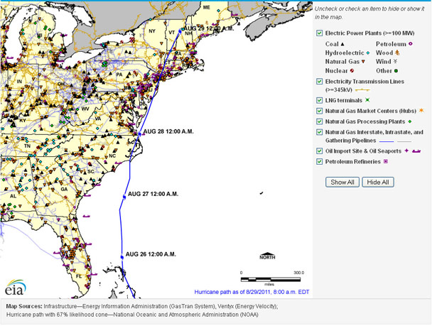
Hurricane Irene, currently expected to approach the coast of North Carolina on Saturday, August 27, is likely to be the first major hurricane to make landfall in the United States since Hurricane Ike in 2008. The Energy Information Administration has updated an interactive mapping tool on its website so that users see the projected path of Hurricane Irene relative to major energy infrastructure—power plants, storage terminals, pipelines, petroleum refineries, liquefied natural gas terminals, natural gas processing facilities, and electricity transmission lines—on the East Coast of the U.S.
The National Hurricane Center is posting routine updates on the status of Hurricane Irene.
Also, the Department of Energy's Office of Electricity Delivery and Energy Reliability is posting daily updates on the disposition of United States energy infrastructure in the Energy Assurance Daily report and posts information on hurricane-related situation reports.