The coastlines of the United States are not borders of the United States
The U.S. border is actually 200 miles away from the U.S. coastline. This area around the country is called the Exclusive Economic Zone (EEZ), and energy production in the area is called offshore production.
In 1983, President Ronald Reagan claimed the EEZ in the name of the United States. In 1994, all countries were granted an EEZ of 200 miles from their coastlines under the International Law of the Sea.
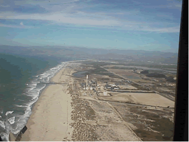
Image of a coastline
Source: Stock photography (copyrighted)
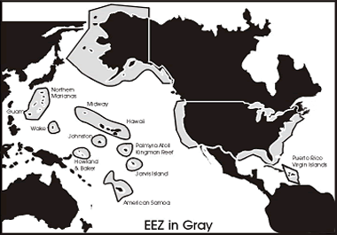
Map showing Exclusive Economic Zone around the United States and Territories
Source: National Energy Education Development Project (public domain)
The ocean floor gradually descends from the shoreline into the ocean on a continental shelf. The width of the U.S. continental shelf varies from 10 miles to 250 miles (16 kilometers to 400 kilometers). The water on the continental shelf is relatively shallow, rarely more than 500 feet to 650 feet (150 meters to 200 meters) deep. The ocean floor drops sharply from the shelf down a continental slope to abyssal plains that are 2 miles to 3 miles (3 kilometers to 5 kilometers) below sea level. Many of the plains are flat, but others have jagged mountain ridges, deep canyons, and valleys. The tops of some of these mountain ridges form islands where they extend above the water.
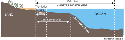
Diagram of shore and ocean overlaid with territorial sea, Exclusive Economic Zone, the Continental Shelf, and Continental Slope
Source: National Energy Education Development Project (public domain)
Several federal government agencies manage the natural resources in the EEZ. The U.S. Department of the Interior's Bureau of Ocean Energy Management and Bureau of Safety and Environmental Enforcement manage the development of offshore energy resources by private companies. These companies lease some offshore areas for energy development from the federal government. These companies pay royalties to the government on the energy resources they produce from the leased areas in the ocean. Most states control the 3-mile area that extends off of their coasts, but Florida, Texas, and some other states control the waters for as much as 9 miles to 12 miles off of their coasts.
Last updated: April 16, 2024.